13.4 The Canadian Cordillera

David Thompson (1770-1857) is famous for two accomplishments: his work as an explorer and surveyor (which includes crossing the continent and descending the Columbia River to its mouth, as well as mapping a prodigious amount of North America) and for having the longest marriage on record in the history of pre-Confederation Canada (58 years).

Thompson was raised in poverty in London, indentured to the HBC at 14 years, and spent much of the rest of his life in the fur trade. In 1797 he literally walked away from his job with the HBC, trudging 80 miles in the snow from one trading post to another where he took up work with the NWC. It was in his capacity as a surveyor for the Montrealers that he was dispatched to the far west in 1806 in order to block American plans to exploit the route mapped by Lewis and Clark, and to access the sea otter resources that had been enriching fur traders from other nations.

Thompson arrived at the mouth of the Columbia on July 14, 1811, only to find Astor’s crew of Americans and defected Nor’westers already on the scene, building Fort Astoria. Their arrival preceded Thompson’s by a few months, but events in the east were to catch up with the Astorians. The War of 1812 would result in the loss of much of Astor’s operations in the Great Lakes and in the far west, to the benefit of the NWC.

The NWC in the Interior

The Montrealers purchased Astoria and its tributary posts in 1813 and changed the name to Fort George. They then renewed and extended a chain of forts up the Columbia with one branch heading east through the Arrow Lakes to the southern Prairies and the other through the Okanagan Valley to Tk’əmlúps (aka Kamloops), where they established Thompson Rivers Post in place of the PFC’s Fort Cumcloups. This early land-based fur trade was, thus, linked back to Canada and not to Britain. On the ground the NWC in the farthest west was mostly Canadien, not Canadian, with a large and growing share of Métis women as well. Regardless of its Laurentian links, it was very much a British claim nevertheless.

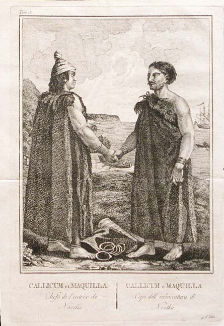
One of Thompson’s contemporaries in the NWC, Simon Fraser (1776-1862), made a comparable assault on the far west in 1803-1808. Fraser came to Canada from New York as a child in the Loyalist diaspora, but he was conscious of his ancestral Scottish roots. While in the north he applied the name “New Caledonia” to the region, which later would have a broader use, covering much of what is now British Columbia. Before descending the river that now bears his name, Fraser’s expedition, made up of mostly Canadiens, Métis, and some Iroquois, established a chain of posts that included Fort St. James and Fort George (later Prince George). In 1808 the voyageurs took on the river, stopping briefly at Camchin (Lytton) where the Nlaka’pamux impressed them with their hospitality, their string of about 1,000 ponies, and a robust human population of roughly 1,200. Fraser and his crew carried on to near the mouth of the river where they irritated the Musqueam (a.k.a. Xwméthkwiyem or xʷməθkʷəy̓əm), who chased them back up the river. Regardless of Fraser’s failure to complete his mission, he had laid the groundwork for the northern leg of a chain of forts that would complete the link between Fort George of the north and Fort George of the south (formerly Fort Astoria) and British North America. This was the setup that the HBC inherited in 1821.

Fur trade society in New Caledonia and the Columbia District was consistent in many respects with personnel and practices east of the Rockies: Canadiens and Iroquois provided much of the muscle while direction was in the hands of a closely connected set of Anglo-Scots-Canadians and their métis or native wives. After the merger in 1821, the HBC’s structure made these distinctions even more apparent: the chief traders and factors were all drawn from the Anglo-Protestant side of the house while the voyageurs and traders were overwhelmingly Canadien, Métis, and Iroquois. Hierarchical social stations were reinforced through a dress code, the layout of the forts, and the size and state of employee accommodations. This sort of physical display of paternalistic rank was intended to impress upon the “servants” of the HBC their relative position; it was also ritualized in ways to impress the Aboriginal trading partners.

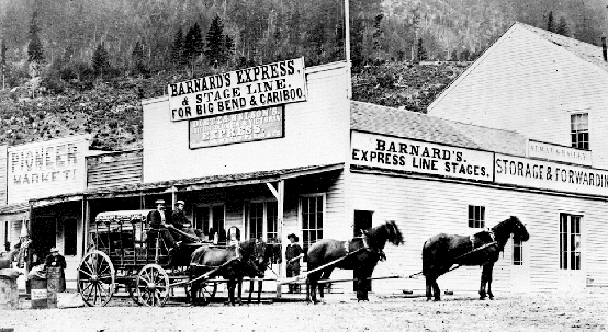
The Interior posts were remarkably fragile. At the far end of supply lines originating in Montreal or perhaps even London, they were vulnerable to any number of events that might delay or prevent the arrival of food, gunpowder, clothing, and trade goods. Every one of the inland forts at some time or another depended heavily on local salmon fisheries, all of which were zealously controlled by Aboriginal peoples. And they were isolated from one another: boats could make it down the Columbia from the lower Okanagan (south of the 49th parallel) to the sea and canoe travel that was possible between Alexandria in the Cariboo to Stuart’s Lake in the north, but all of the rest required packhorses. Famine was common, as was the consequent eating of horses and dogs.[footnote]Tina Loo, Making Law, Order and Authority in British Columbia, 1821-1871 (Toronto: University of Toronto Press, 1994), 28-9.[/footnote] According to one historian,

New Caledonia (mainland British Columbia) was particularly despised for its “misery and privation” and “poverty of fare.” Chief Factor John Tod recalled that in HBC Governor George Simpson’s Day (1820-1860) the district was “looked on in the light of another Botany Bay Australia; the men were in dread of being send there.”[footnote]Ibid.[/footnote]

Fines, beatings, and jailings were part of life in the forts of the far west. Relations with the Aboriginal neighbours and trading partners were also often characterized by brutality.[footnote] Cole Harris, The Resettlement of British Columbia: Essays on Colonialism and Geographical Change (Vancouver: UBC Press, 1997), 44.[/footnote]

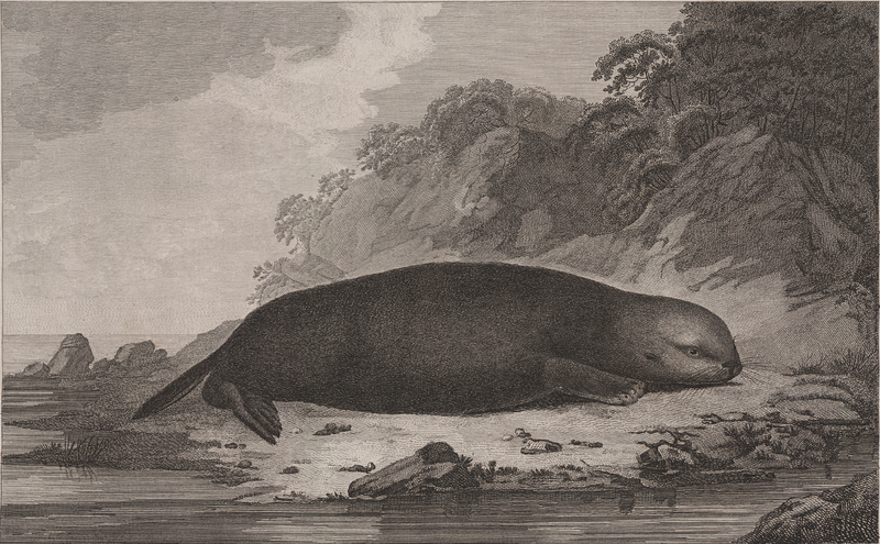
Obviously the Interior trade was not concerned with sea otters. Whatever was brought in at the Columbia River posts was part of the package sent northeast to Hudson Bay each spring, but beaver, wolf, wolverine, muskrat, and a great variety of other hides came from the inland posts. As for imported goods from European and Euro-North American sources, there was the usual stock of rifles and shot, blankets and axe heads. There was also a thriving trade in leather: whether for ecological reasons or due to overhunting, the Interior Plateau was home to few large mammals, so the import of moose, deer, elk, and bison hide was quickly regarded as essential. As one study states, “in the 1827-28 outfit year, New Caledonia required two thousand fathoms [3650 metres] of pack cords, seventy bounds of babiche [string], and thirty pounds of sinews.”[footnote]James R. Gibson, The Lifeline of the Oregon Country: the Fraser- Columbia Brigade System, 1811-47 (Vancouver: UBC Press, 1997), 26.[/footnote]

The HBC on the Coast

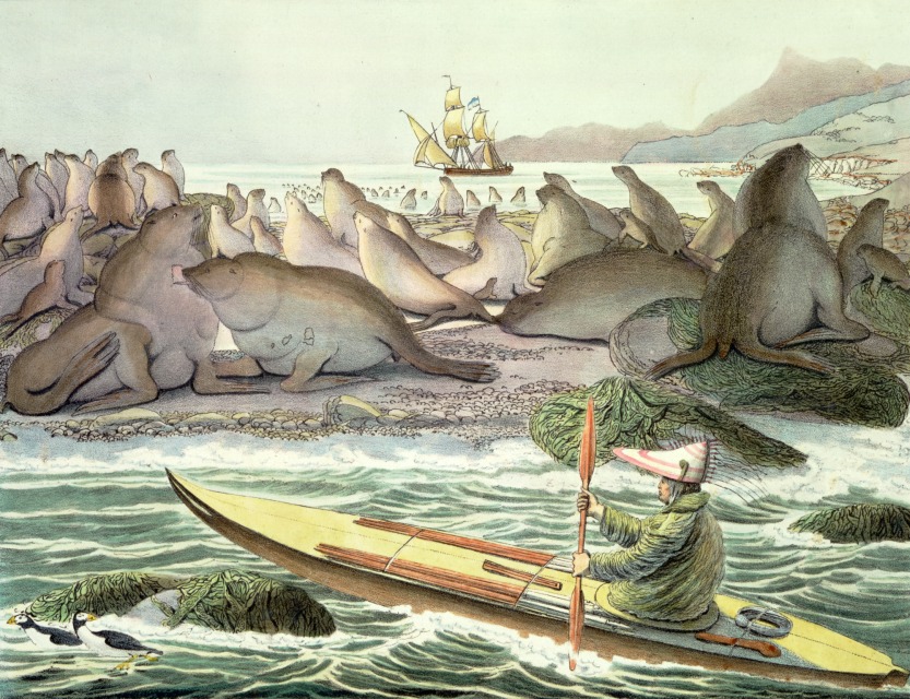
The newly unified HBC after 1821 had growing concerns regarding the leakage of furs from the Interior to the coast, where they fetched higher prices. As well, the company under the leadership of George Simpson wanted to improve its position on the coastal market. So long as First Nations trading villages were prepared to wait for two or more competing vessels to arrive in port before initiating trade, they would be able to play off the newcomers against one another and drive up prices. American ships in particular were prepared to pay premium prices for furs, a practice that was hurting the HBC bottom line.

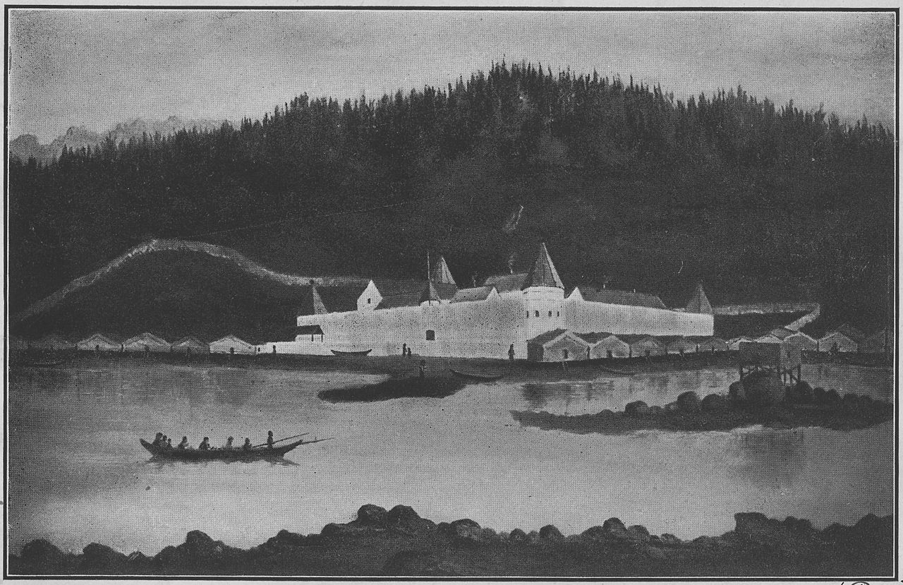
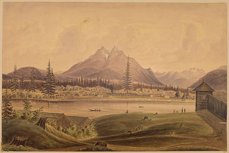
The solution to this was the establishment of land-based trade in centres that would entail a shift from a maritime-based trade strategy. The HBC established regional headquarters at Fort Vancouver in 1824-25 and at Fort Langley among the Stó:lō and Kwantlen in 1827. Two successive forts, both named Fort Simpson, were erected in Ts’msyan territory in 1831 and 1834, Fort McLoughlin was built on Heiltsuk lands in 1833, and Fort Taku (a.k.a. Fort Durham) in 1830 and Fort Stikine in 1840 were both in Lingít (Tlingit) territory. The north coast posts were intended to provide a permanent trading presence in the hope that a deeper commitment to the locale, better intelligence on the marketplace and supply lines, and lowered costs (due to an end to wandering trading vessels) would result in higher profits. By the late 1830s the strategy was deemed a success. American shipping and competition in the region declined sharply.

This had two collateral effects.  First, the Russians in Alaska were affected. The Lingít nation of what is often referred to as the Alaska panhandle resented Russian posts and resisted their presence in a long-running war. In the absence of friendly local suppliers and faced with intolerably long supply lines back to Russia, the Russian American Company purchased foodstuffs from American captains. Second, the Americans, for their part, could only afford to pay high prices for sea otter and beaver if their costs were covered by Russian purchases of groceries.[footnote]James R. Gibson, “Bostonians and Muscovites on the Northwest Coast, 1788-1841,” in British Columbia: Historical Readings, eds. W. Peter Ward and Robert A.J. McDonald (Vancouver: Douglas & McIntyre, 1981), 77.[/footnote] The new forts were intended to be self-sufficient and to produce a food surplus that could be sold to the Russian forts cheaply. This cut directly into the American coasters’ trade, removed them from the northwest coast equation, and made the Russians dependent on the HBC.

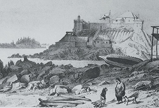
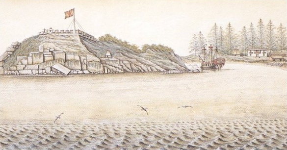
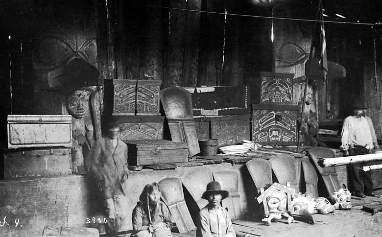
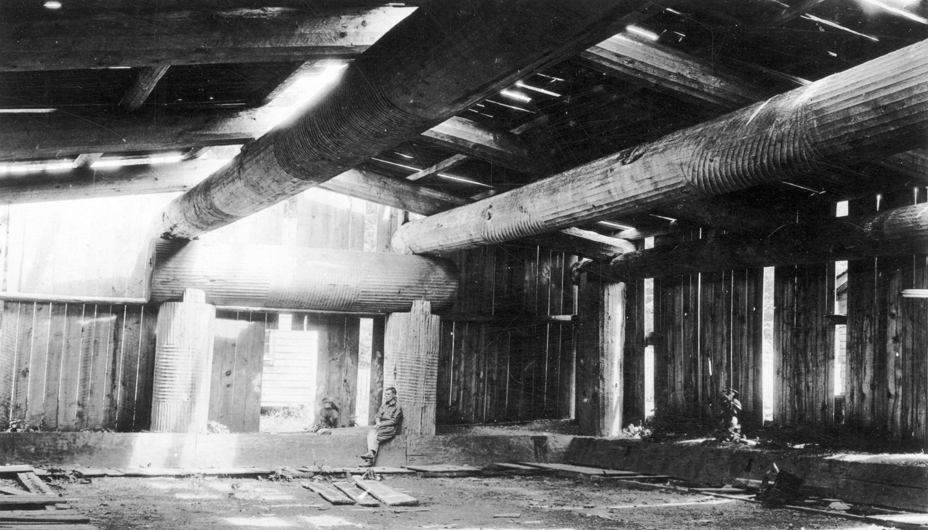
Whatever the forts may or may not have become over time, the agenda of the HBC was never colonization. That was something forced upon them by the Colonial Office in the 1850s; the HBC was simply interested in business on the coast. However much fur trade society might have been evolving within the walls of the forts along the coast, there is no denying that they were little citadels. A description of Fort Simpson from 1850 provides a sense of the traders living uncomfortably in Aboriginal territory:

The gates were massive structures about six or seven inches thick, studded with large nails, to guard against their being cut down by the natives. There were small doors within so as to admit only one person at a time…. The pickets surrounding the establishment were of cedar, about twenty-two feet long by nine to twelve inches thick; they were square internally, to prevent bullets from passing between…. An inside gallery ran around the whole enclosure of pickets at about four feet from the top, and afforded a capital promenade and a means of seeing everything…. A regular watch was kept all night in a small turret, surrounded by the flagstaff, over the gate.[footnote]Captain David Wishart quoted in Daniel Clayton, “Geographies of the Lower Skeena,” in Home Truths: Highlights from BC History, eds. Richard Mackie and Graeme Wynn (Madeira Park: Harbour, 2012), 111.[/footnote]

Fort Simpson was conceptualized by HBC Governor George Simpson as a means of starving out Russian and American traders in the region. Even if the returns on investment were not especially good, at least the furs traded at Lax Kw’alaams and from upcountry sources were not finding their way into the hands of competitors. Certainly the size of the traffic at the fort suggests the strategy was working: in 1841 roughly 14,000 Aboriginal people — mostly Ts’msyan but also Haida — came to Fort Simpson, and about 800 Ts’msyan formed the homeguard.[footnote]Richard Mackie, Trading Beyond the Mountains: The British Fur Trade on the Pacific, 1793-1843 (Vancouver, UBC Press, 1997), 129.[/footnote]

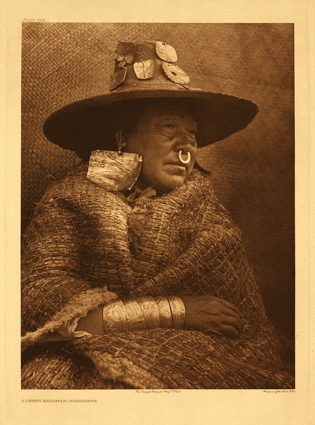
While Governor Simpson played a very direct role in choosing a direction for British trade on the coast, the day-to-day operations and initiatives came from officers, Canadiens, and Métis. These were the people who forged relationships with the local people, and whose marriages to indigenous women changed their circumstances. As Cole Harris points out, “As time went on, they learned Native languages and had kin in Native villages.”[footnote]Cole Harris, The Resettlement of British Columbia: Essays on Colonialism and Geographical Change (Vancouver: UBC Press, 1997), 47.[/footnote] Fur trade society on the coast and in the Interior was invariably made up of women and men who had travelled across great distances, who had witnessed incredible landscapes and hardship, whose mothers may have spoken Cree, and whose fathers may have lived in stone houses in Montreal. The local women drawn into these relationships were often part of the local nobility and so came from backgrounds of some privilege. The company might object from time to time — after all, more marriages with Native women meant more profitless gift-giving to their families — but even Simpson perceived these arrangements as loss leaders, a cost that would be repaid with security and a guarantee of trade.

Innovation and adaptation spread to business as well. Trade on the West Coast presented opportunities to handle different goods in different markets. Salmon, flour, and lumber were wanted in Hawaii and furs had markets in Guangzhou and London. The profits from the fur trade amassed in London and Montreal, not in the HBC’s trading posts on the Pacific; what they needed in return for their exports included sugar, molasses, tobacco, and salt in particular.[footnote]Mackie, Trading Beyond the Mountains, 250-3.[/footnote] The sustainability of any of the northwest coast forts was a stretch until the 1840s, certainly were it not for the support of Aboriginal traders.

An Account of Trading at Fort Simpson in the 1830s

The Indians coming from distant parts to this fort, have large canoes, from thirty to fifty feet long.… Besides containing numerous Indians, their canoes are piled up with goods for barter. They remain mustered here for some weeks, making the fort a complete fair. It requires strict and good management, at this time, by the companies of officers, to protect the fort. On landing at the fort, their canoes are piled up in large heaps, covered over with mats, to keep the sun from cracking them. They bring provisions with them, to last during their stay and journey home. Feasts are given by the chiefs; and invitations sent regularly round to the different guests. Should any of the officers of the fort be invited, stools are placed by the side of the fire, covered over with cloth and fine calico; and they are introduced with great ceremony – the chiefs standing to receive them. Skins are given, as presents, to the officers; and in the course of a day or two, the trader returns the compliment, by making them presents of British manufactured clothing.

– John Dunn, History of the Oregon territory and British North-American fur trade;with an Account of the Habits and Customs of the Principal Native Tribes on the Northern Continent (London: Edwards and Hughes, 1844): 281-2.[footnote]Quoted in Ibid., 130-1.[/footnote]

Key Points

  • The NWC’s presence in New Caledonia and events in the War of 1812 led to the temporary elimination of American interests from the Columbia District and the Canadianizing of a chain of fur trade posts from the mouth of the Columbia north through the Okanagan, the Cariboo, and the Peace District as well as through the Arrow Lakes.
  • New Caledonia was considered by many in the NWC/HBC as a hardship post.
  • The HBC’s post-1821 strategy of building trading posts on the coast was intended to intercept furs headed from the Interior to the maritime-based trade for higher prices.
  • The HBC’s land-based coastal trade strategy broke the back of American seaborne trade and crippled the Russian traders’ business model.
  • Fur trade society west of the Rockies witnessed extensive intermarriage in the context of an often marginal trade. The HBC diversified in the 1830s and 1840s and did more to connect the peoples of the Pacific Northwest with those of Hawaii and China.
Posted in Uncategorized | Leave a comment

13.3 Fur Trade and Empires

This ungainly interpretation of a sea otter comes from James Cook's account, A Voyage to the Pacific Ocean (1776). (Attributed to S. Smith, after John Webber.)

Figure 13.7 This unflattering depiction of a sea otter comes from James Cook’s account, A Voyage to the Pacific Ocean (1776). (Attributed to S. Smith, after John Webber.)

The Russians

The catalyst for European interest in the Pacific Northwest in the 18th century was Russian exploration. The Sv. Petr, under the command of Vitus Bering (1681-1741) arrived in the Aleutian Islands in 1741 as part of an exploratory expedition. The ship was wrecked, Bering died, and just enough of his crew survived to get home in a makeshift boat cobbled together from what was left of the Sv. Petr. They went back with sufficient sea otter pelts to win a small fortune. Russian entrepreneurs and shipowners were soon following in Bering’s path. Enslaving much of the indigenous Aleut (a.k.a. Unangan) population and terrorizing much of the rest, the Russian traders established a presence that eventually stretched south to California. These events occurred against a backdrop of growing Russian expansionism. Under Elizabeth of Russia and her successor, Catherine the Great, Russia’s imperial ambitions and aggressive posture grew. All this alarmed the Spanish (see below), who first heard of the move into Alaska in the imperial Russian court.

Bering and his successors may have had the blessings of the empresses, but they also faced great challenges, the first of which was supply lines. The huge cost of running their operation out of Okhotsk limited the Russians, which is one reason why they were largely uninterested in settlement until the 1780s and 1790s. The agricultural potential of Alaska, with its short growing season, was another impediment to self-sufficiency. The Russians faced further disadvantages in the marketplace. They were denied access to Guangzhou and had to carry their pelts across Siberia to Kyakhta, south of Lake Baikal, where they could cross the border into China. This added further costs.[footnote]James R. Gibson, “Bostonians and Muscovites on the Northwest Coast, 1788-1841,” in British Columbia: Historical Readings, eds. W. Peter Ward and Robert A. J. McDonald (Vancouver: Douglas & McIntyre, 1981), 70.[/footnote]

Aleut (Unangan) seal hunter  off the Alaskan coast, as painted by the Ukrainian, Louis Choris, ca.1815-18.

Figure 13.8 Aleut (Unangan) seal hunter off the Alaskan coast, as painted by the Ukrainian artist, Louis Choris, ca. 1815-18.

Some of the competitive elements of the Russian trade began to consolidate by the 1780s. In 1799 Czar Paul I decreed a Russian-American border at 55°N (near the southern limit of the Alaskan panhandle) and chartered a joint stock company to take monopolistic control of the fur trade: the Russian American Company (RAC). Almost immediately the company’s chief manager, Alexander Andreyevich Baranov (1746-1819), adopted a policy of contracting out to American ships in the region. In 1803 two Russians and some 40 Aleuts and Alutiiq otter hunters sailed to Baja California on board an American ship. Over the next decade, it is believed that tens of thousands of otters were captured along the California coast by Alaskan Aboriginals in the employ of — or, more typically, enslaved by — the RAC and working from American ships.

The first permanent Russian (and thus the first European) settlement in Alaska was established at Novo-Arkhangelsk (New Archangel, or Sitka) in 1804, which hardened Russian claims to the territory. As well, in 1812 the Russians were able to leapfrog their British and American competition and establish Fort Ross (a.k.a. Fortress Ross) in what is now northern California. All of these events coloured the Russians as something of a wildcard on the coast: the vulnerabilities to RAC’s supply line sustained independent and sometimes reckless traders; Russian relations with the Lingít (Tlingit) were terrible and poisoned Aboriginal-newcomer relations south of the panhandle; and the Russians never entirely lost sight of the possibility of a Californian colony — Fort Ross remained in Russian hands until 1841.

Old Sitka, ca. 1827. The most heavily fortified trading establishment on the northwest coast reflects the poor relations its Russian occupants had with Tlingit neighbours.

Figure 13.9 Old Sitka, ca. 1827. The most heavily fortified trading establishment on the northwest coast reflects the poor relations its Russian occupants had with Tlingit neighbours.

The Spanish

In 1774 a Spanish naval expedition under Juan Pérez (ca. 1725-1775) worked its way north from California in an effort to assess the threat posed by the Russian presence in Alaska. According to the Treaty of Tordesillas (1494), the whole of the West Coast was Spain’s to lose. The Portuguese honoured the treaty but the rest of Europe did not. Nor did the Aboriginal people of the northwest coast. And why should they? Spain had not ventured north of California, apart from the disputed 1592 voyage of Juan de Fuca in search of the legendary Strait of Anian.

Word of the Russian intrusion worried the Spanish sufficiently that in 1767 they established a naval station at San Blas and posts at San Diego and San Francisco two years later. Five years after that, the Spanish mustered Perez’s small expedition to chart and claim the North Pacific. Although the Spanish made their way as far north as Alaska and erected a cross there, they made no other landfall north of what is now Washington State. The Spanish were satisfied that there was no Russian presence between Mexico and 57°N.

A second expedition set out in 1779 under the Peruvian-born Juan Francisco Bodega y Quadra (1744-1794), sailing north again to Alaska. On this occasion the Spanish were looking for the outlet of a “northwest passage” that would lead to the Arctic Ocean or perhaps to the Saskatchewan or the Missouri Rivers. They sailed to 61°N and went ashore to ritually claim the territory, then returned home, assuming the job was done and that they could now relax or at least focus on the freshly announced war with Britain.

Having run up the flag on the northwest coast in 1774 and 1779, the Spanish were surprised to find they needed to monitor and perhaps defend their position, though not, as they might have expected, against Russia. Britain’s appearance in 1778 in the form of James Cook’s third expedition alerted the Spanish to the need to establish a fixed position on the north coast. In 1788 a pair of Spanish ships made another voyage to Alaska, this time finding the Russians and discovering that they had plans to establish a post on Nootka Sound in the territory of the Mowachaht. Returning to Mexico, the Spanish launched yet another expedition, intent on claiming Nootka Sound for their own. When they arrived they found two American ships and one British; the Spanish banished the latter and then seized the North West America, a vessel owned by the British independent trader, John Meares, and built on Nootka Sound by a crew of Chinese workers brought to Yuquot by Meares — the first Chinese arrivals in British Columbia. The Spanish put the Chinese to work building Fort San Miguel, thereby creating a physical statement of sovereignty. These aggressive efforts to assert Spanish sovereignty provoked what became known as the Nootka Crisis, which began in 1789 and lasted five years.

In terms of developing Aboriginal-European interaction, the Spanish had one advantage over their contemporaries: they alone of the European and North American visitors to the North Pacific had an interest in territory first and commercial ventures second. Once the British were disabused of the existence of a northwest passage their only concern was furs. The same was true, only more so, of the Russians and Americans. In contrast, Bodega y Quadra was looking at the long term, and therefore thinking about building lasting relationships with the Aboriginal people. This was what he hoped to do at Fort Miguel in 1791-93.

Bodega y Quadra was, by all accounts — and certainly by George Vancouver’s account — charming, curious, and smart. The leading figure among the Mowachat, Maquinna (ca. 1795), was particularly impressed with Bodega y Quadra’s ability to assimilate local customs and to show respect to the local leaders. And Bodega y Quadra’s reports on matters in Nootka Sound from 1790 to 1793 were insightful. These include his belief that Euro-American traders cynically stirred up trouble in order to improve the market for guns and ammunition; that syphilis was spreading unchecked from British and American ships to the indigenous population; that traders from abroad were never above plundering the Nuu-chah-nulth villages if they didn’t get what they wanted under terms that they wanted; and that the European responses to minor thefts or single murders by the Aboriginal population was typically a violent overreaction. Bodega y Quadra spent two years repairing relations after Callicum, one of the Nuu-chah-nulth leaders and a close relation of Maquinna, was shot dead by the Spanish (under circumstances that remain unclear).

An engraving produced in John Meares' account of his time on the northwest coast shows Callicum and Maquinna greeting one another (c.1796).

Figure 13.10 A contemporary engraving shows Callicum and Maquinna greeting one another. Callicum’s murder at the hands of the Spanish nearly revived the European nation’s 300-year old reputation for brutality in its relations with indigenous peoples.

Like the Russians, the Spanish operated under several important disadvantages. While they could trade into Chinese seaports (unlike the Russians) their objective was to obtain Asian mercury  to support their gold and silver processing operations in Mexico. The sea otter trade was, for the British, Americans, and Russians, about selling cheaply acquired pelts and obtaining highly desirable Chinese products — tea, silk, porcelain — for sale at a further profit in Europe. For the Spanish, it was about enhancing gold production in Mexico. The “Mercury Fleet,” as it was known, from Europe, however, could deliver materials more cheaply than the Spanish could in the Pacific.

As well, the Spanish could hardly muster sufficient resources to blast British, American, and Russian competition off the coast. For that reason, and because they sensed that Mexico’s security might be compromised by Britain and/or America, they retreated.[footnote]Christon I. Archer, “The Transient Presence: A Re-appraisal of Spanish Attitudes Toward the Northwest Coast in the Eighteenth Century,” in British Columbia: Historical Readings, eds. W. Peter Ward and Robert A. J. McDonald (Vancouver: Douglas & McIntyre, 1981), 37-65.[/footnote] As one historian has put it,

The Spanish regime lacked the motivation or the population to maintain its sovereign claims to the coastline and ocean north of California. Other than the northwest coast Natives sent to Mexico and perhaps a few mestizos born at Nootka Sound, the Spanish efforts left little impact upon the Native societies. […] Even before [the last of the Spanish and British ships left Yuquot in 1795], Maquinna’s people were hard at work erecting house posts for their summer village.[footnote]Christon I. Archer, “Seduction before Sovereignty: Spanish Efforts to Manipulate the Natives in Their Claims to the Northwest Coast,” in From Maps to Metaphors: The Pacific World of George Vancouver, eds. Robin Fisher and Hugh Johnston (Vancouver: UBC Press, 1993), 159.[/footnote]

Fort San Miguel at Yuquot, 1793.

Figure 13.11 Fort San Miguel at Yuquot, 1793.

The Nuu-chah-nulth would continue to trade with Europeans for decades, but they did not permit the outsiders to re-establish themselves anywhere on their coast. Fort San Miguel would be the last European toehold on Vancouver Island until the 1840s.

The British

European claims to a territory could have the most tenuous foundation. In 1577 Sir Francis Drake (1540-1596) sailed from Plymouth Harbour in England with orders from Queen Elizabeth I to terrorize and pillage the Spanish gold fleet in the Pacific Ocean. The mission evolved into England’s first circumnavigation of the globe but, more importantly for the history of the Pacific Northwest, it allowed Britain to lay claim to lands north of Mexico. Drake’s account puts him just north of San Francisco Bay in 1579, which he named Nova Albion (New Albion). Scholars continue to debate whether Drake ventured farther north, but this 16th century interlude was the basis on which Britain built its claim 200 years later. When he mapped a place on the northwest coast in the 1790s, Captain George Vancouver’s notations would include the phrase “from that part of New Albion.”[footnote]Cole Harris, The Resettlement of British Columbia: Essays on Colonialism and Geographical Change (Vancouver: UBC Press, 1997), 31.[/footnote]

In 1774, James Cook (1728-1779) led a British expedition into the Pacific Northwest. Cook’s ships rounded South Africa, Australia, and New Zealand, set out for Hawaii, then reached the Americas at Alta California. Sailing north, he narrowly missed both the Columbia River and Juan de Fuca Strait but found his way to Yuquot (Friendly Cove).

Cook spent a month there enjoying the hospitality of the Nuu-chah-nulth and becoming acquainted with their self-confident and sharp trading practices. The people of Yuquot and Tahsis weren’t satisfied with the cheaper goods that had been traded with the Hawaiians, and they controlled the terms of trade throughout. When they were done, Cook’s two vessels continued north and successfully rounded the North Pacific before heading back to Hawaii, where the captain was killed by the locals. The Resolution and the Discovery continued the voyage home, stopping in Guangzhou (Canton). There they discovered what the Russians already knew: the sea otter pelt market in China was extremely lucrative. British and American interest in the region was thereafter stimulated.[footnote]Robin Fisher, Contact and Conflict: Indian-European Relations, 1774-1890, 2nd ed. (Vancouver: UBC Press, 1992), 1-23.[/footnote]

The Launch of the North West America at Nootka Sound shows Europeans (presumably John Meares) and Aboriginal observers, but the Chinese labourers who built the ship are conspicuous by their absence.

Figure 13.12 The launch of the North West America at Nootka Sound shows Europeans (presumably John Meares) and Aboriginal observers, but the Chinese labourers who built the ship are conspicuous by their absence.

Cook’s voyages provoked the Spanish to press their regional claims. The British pressed right back. The two countries nearly went to war over the question of whose claim was the stronger. Captain George Vancouver (1757-1798), was the British representative on the scene at Yuquot; Juan Francisco de la Bodega y Quadra represented the Spanish. Various accounts of this meeting have been written, at least one fictionalizing the encounter. What they have in common is Vancouver’s moodiness and obstinance compared with Bodega y Quadra’s smoothly seductive hospitality. Events in Europe were to overtake them: in 1792 the French Revolution was threatening to spread beyond the borders of France, and the Spanish decided to sacrifice their northwest coast claim in exchange for British goodwill. As a result, the British gained nominal control of everything between Alta California and Russian Alaska. The negotiators at Yuquot agreed to mark the event by naming the island after themselves. For many years it appeared on European and American maps as “Bodega y Quadra and Vancouver’s Island” (shortened later to Vancouver’s Island, and finally Vancouver Island).

In the Navy

James Cook and his contemporaries were some of the most remarkable cartographers of all time. Their maps are still reliable today, and Cook’s 1760s maps of Newfoundland were the gold standard into the 20th century. Their careers intersect with the stories of British North America, Australia, New Zealand, and Hawaii. Cook was at Louisbourg when it fell in 1755 and commanded a ship under Wolfe at the Battle of Quebec four years later. George Vancouver joined the Royal Navy at 13 and served with Cook from the age of 14. William Bligh was only seven when he was signed up with the navy and his career would see more than the usual amount of drama.

Cook once declared that his goal was to go “farther than any man has been before me, but as far as I think it is possible for a man to go.” Both Vancouver and Bligh had a chance to study under Cook and were with him on the last of his three voyages. They all kept their pencils pressed against map paper constantly. They were together on the Resolution in Hawaii when Cook made the fatal choice to go ashore one time too many. Vancouver’s career was just starting. He was barely 20 years old when he was given command of the Discovery, a four-year mission to explore the Pacific in greater detail, and a mandate to settle the practical terms of the Nootka Convention. Along with two Spanish captains, Dionisio Alcalá Galiano and Cayetano Valdés y Flores, he charted the Strait of Georgia (the Salish Sea) and passed within sight of the peninsula on which the city bearing his name was later built. Bligh, for his part, has an island bearing his name in Nootka Sound. He would take command of the Bounty in 1787, a ship irretrievably associated with mutiny.

Having sovereignty on paper, however, did nothing to enhance the British position. They continued to engage in trade, but that didn’t stop others parties from arriving on the coast. Like Quadra, Vancouver had little use for the travelling fur traders, particularly those who were selling guns. He regarded their tactics as deplorable and wrote to his superiors:

I am extremely concerned to be compelled to state here, that many of the traders from the civilised world have not only pursued a line of conduct, diametrically opposite to the true principles of justice in their commercial dealings, but have fomented discords, and stirred up contentions, between the different tribes, in order to increase the demand for these destructive engines… They have been likewise eager to instruct the natives in the use of European arms of all descriptions….[footnote]George Vancouver, A Voyage of Discovery to the North Pacific Ocean, and Round the World: In which the Coast of North-west America Has Been Carefully Examined and Accurately Surveyed : Undertaken by His Majesty’s Command, Principally with a View to Ascertain the Existence of Any Navigable Communication Between the North Pacific and North Atlantic Oceans, and Performed in the Years 1790, 1791, 1792, 1793, 1794, and 1795, in the Discovery Sloop of War, and Armed Tender Chatham, Under the Command of Captain George Vancouver : in Three Volumes, Vol.2 (London: G.G. & J. Robinson, 1798), 364.[/footnote]

In terms of imperial diplomacy, the British had come out ahead, but the Americans (see below) had the whip in hand when it came to trade. The British would have to change their strategy dramatically and the incentive to do so would come from Canada. By 1830 British traders were back in the game, supported by forts on the Columbia River and at Langley. It would be another 10 years before they could claim real regional domination over the other intruder traders. Authority over the Aboriginal population would take longer still.[footnote]James R. Gibson, Otter Skins, Boston Ships, and China Goods: The Maritime Fur trade of the Northwest Coast, 1785-1841 (Montreal & Kingston: McGill-Queen’s University Press, 1992), table 1, pp.299-310.[/footnote]

The Americans

Even as the American Revolution was raging it was clear to shipowners in East Coast ports that their access to British markets might be in danger. Britain took steps to prohibit American access to the West Indies market, a move that favoured the new British North American colonies and that left American ship captains looking farther afield. Necessity took them out of the North Atlantic and into the Mediterranean and North Africa, down the east coast of South America and round Cape Horn into the Pacific. It found them trading in the South China Sea and, almost inevitably, along the northwest coast.

"Winter Quarters." by George Davidson (ca.1793), depicts the American Captain Robert Gray and the crew of the Columbia Rediviva on Clayoquot Sound.

Figure 13.13 “Winter Quarters.” by George Davidson (ca. 1793), depicts the American Captain Robert Gray and the crew of the Columbia Rediviva on Clayoquot Sound.

There were two aspects to the American trade in the region. The first was its maritime face. The Americans put more ships into the region than any other nation. Although British ships dominated from 1785 to 1792, they were increasingly competing with American vessels (one-to-one in 1791 and 1792), as well as the occasional French or Portuguese ship. In the two decades that followed, the British presence slipped well behind that of the Americans. In 1801 more than 20 American vessels found their way to the Pacific Northwest; in the same year only three British ships and one Russian ship were in the area. Soon the British were down to one ship a year, although it was usually the same ship making repeat visits. The American fleet, by contrast, was made up of competing traders; often their name appears only once in the register. Continuity was an issue because one-timers tended to behave in ways that were not necessarily in the best interest of long-term trade relations. The sales of guns and alcohol were a particular problem. [footnote]Ibid.[/footnote]

In short, as far as the maritime trade was concerned, the Americans had the edge. It was, however, an uncoordinated edge. The independent ships from Boston and other New England ports had no imperial mandate, nor were they acting on behalf of the new republic. Later American claims to the territory might invoke some of the earliest expeditions in the region, but the fur trade fleets were of little value in this regard.

The land-based trade posed different advantages and liabilities. John Jacob Astor (1763-1848), a German immigrant to the United States who saw an opportunity in shipping Canadian furs through New York to Europe in the 1790s, amassed a substantial fortune in just a few years and was eager to involve himself more directly in the fur trade. He developed a multi-pronged strategy, one part of which was the Pacific Fur Company (PFC) and the prospect of a fort on the Columbia River, which he named for himself. Astor’s company seemed fated from the outset. The Tonquin disaster (see Identity Crisis) was the worst of it, but another of the PFC’s ships proved to be not seaworthy, a third was badly beat up by a storm, and a fourth was wrecked off the coast of Maui. One study estimates that the PFC lost 61 men in less than two years. The trade conducted from Fort Astor was negligible. Astor’s own employees were quickly turning against him, and war had broken out between the Americans and the British in North America.[footnote]Richard Mackie, Trading Beyond the Mountains: The British Fur Trade on the Pacific, 1793-1843 (Vancouver, UBC Press, 1997), 15-16.[/footnote] A quick sale to the NWC in 1813 was the outcome.

One legacy of Astor’s expeditions was picked up by several American traders — that of provisioning other fur trading outposts, regardless of who owned them. The cost of establishing, maintaining, and provisioning a trading post in the region was all but prohibitive, but American suppliers offered a solution. Every post in the Pacific Northwest at some point took advantage of the opportunity to restock with American goods, even though doing so was essentially underwriting the costs of the competition. Severing this link between American suppliers and the Russian traders in particular was key to British success in the region, but that goal was only achieved in the 1830s. Thereafter the prohibitively high costs of trade in the region combined with sharply declining sea otter stocks to reduce American shipping to no more than a couple of ships a year.

A Russian stamp commemorates the 200th anniversary of the establishment of Fort Ross.

Figure 13.14 A Russian stamp commemorates the 200th anniversary of the establishment of Fort Ross.

The Imperial Coast

At some point, Spain, Russia, Britain, and the United States all claimed the Pacific Northwest. Spain dropped its interests with the Nootka Convention of 1793. Russia’s RAC reinforced its positions from Sitka north and west, marking a boundary at 54’40″N latitude in agreements with the United States and Britain in 1824 and 1825 respectively.  American claims to the “Columbia Department” — which included New Caledonia (that is, most of modern British Columbia) along with the future states of Washington and Oregon — were to prove a problem in the 1840s, but otherwise American interest in the region was made up of individual merchant ships. British claims were based on prior discovery, exploration, and treaty rights. As is explored in the next section, the most important imperial agency was the Hudson’s Bay Company, which built on a foundation established by the NWC and engaged in active trade from the Lower Columbia River north to the Arctic Ocean.  From 1816 through to the 1840s, few Americans and Europeans settled in the region and it remained — for these outsiders at least — a venue for trade and they had aspirations to do little more. The Canadians were a different matter.

Key Points

  • European interest in the Pacific Northwest increased in the mid-18th century with the arrival of Russian sea otter traders in Alaska.
  • Russian ambitions in the region included the establishment of permanent posts, subjugating much of the Native population and extending their reach to California.
  • The Spanish were spurred into action in the northwest by the Russian presence and were far more interested in sovereignty than commerce.
  • Nootka Sound (Mowachaht) was the intersection of commercial and diplomatic interests including the host Mowachaht/Nuu-chah-nulth people of Yuquot (Friendly Cove), the Spanish, the British, and nominally independent traders.
  • The resolution of the Nootka Crisis gave Britain the pre-eminent European claim to Vancouver Island and the mainland coast from California to Alaska, but it would be nearly 40 years before they established a post in what is now British Columbia.
  • American traders were the dominant force in the maritime fur trade into the 1830s and their supply lines sustained the Russian presence, making it difficult for the British to turn a profit.
  • The American Pacific Fur Company was the first to establish a fixed presence on the mainland, at Fort Astoria, although this soon fell to the Canadians.
  • The establishment of British forts from Fort Vancouver north to Fort Stikine was a response to the mobile American fur trade.

Attributions

Figure 13.7
Sea Otter by Trycatch is in the public domain.

Figure 13.8
Choris, Saint Paul by Triggerhappy is in the public domain.

Figure 13.9
1827 illustration of Castle Hill by File Upload Bot (Magnus Manske) is in the public domain.

Figure 13.10
Callicum und Maquinna by Hans-Jürgen Hübner is in the public domain.

Figure 13.11
Spanish fort San Miguel at Nootka in 1793 by Onofre Bouvila is in the public domain.

Figure 13.12
The launch of the North West America at Nootka Sound by PawełMM is in the public domain.

Figure 13.13
Columbia Winter Quarters by Pfly is in the public domain.

Figure 13.14
Stamp of Russia 2012 No 1633 Fort Ross by Dmitry Ivanov is not an object of copyright.

Posted in Uncategorized | Leave a comment

13.2 Aboriginal Societies in the 18th Century

For two years after his death, Haida leader Skowl's body lay in state, surrounded by evidence of his wealth, including coppers (shields) and his slaves. (Photo by Albert P. Niblack, 1883)

Figure 13.2 For two years after his death, Haida leader Skowl’s body lay in state, surrounded by evidence of his wealth, including coppers (shields) and his slaves. (Photo by Albert P. Niblack, 1883)

Simon Fraser’s arrival at Camchin (Lytton), at the confluence of the Thompson and Fraser Rivers was foretold. Among the Nlaka’pamux around the end of the 18th century there was a prophecy that foreigners would arrive from the east — although in some respects, they had already arrived.

The Proto-Contact Years

The fur trade on the Plains and the intrusion of Spanish goods — including horses — impacted Aboriginal peoples in the northern reaches of the Columbia basin (the Okanagan and Thompson Valleys) and in the Kootenay valleys. Knowing this, it is possible — indeed, probable — that smallpox arrived in the Cordillera long before the first European appeared. Epidemics in the 1730s and 1760s could have been passed along trade or raid routes, especially once so many of the neighbours to the south and east were able to travel on horseback. The 1780s smallpox epidemic definitely made an appearance. And when Fraser arrived in 1808 he found evidence of European trade commodities among the Nlaka’pamux, proof that there was no such thing as total isolation in this region. It remains uncertain as to when the proto-contact period precisely began in the Interior of what is now British Columbia, but we can be confident that the world encountered by Euro-North Americans from the 1770s on was one undergoing great change.

Notwithstanding the proto-contact experience, Aboriginal societies in the Pacific Northwest enjoyed prolonged isolation from the European invasion taking place in Mexico, the Mississippi, the parklands of the North, and the eastern woodlands. From 1500 to the 1740s, indigenous cultures and populations continued to thrive. There is nothing in the written, oral, archaeological, or geological record to suggest any catastophes to rival the volcanic explosions of about 2,000 and 1,000 years earlier; nothing that would force a massive migration wave. (It is the case, to be sure, that seismic issues are a fact of life in the region. One local traditional understanding of their cause conveys a very usable image of what contemporary science believes occurs: “According to the Nuxalk … a giant supernatural being held the earth in ropes. When he adjusted his grip, or when the rope slipped in his hands, the Nuxalk could feel the tremors and performed a ceremonial earthquake dance.”)[footnote]William J. Turkel, The Archive of Place: Unearthing the Pasts of the Chilcotin Plateau (Vancouver: UBC Press, 2007), 122.[/footnote] The southward movement of Athabaskan speakers appears to have been complete by 1400. After this time the pattern of culture groups seems to have coalesced into the form that enters the European record from the 1740s on.

There are three culture areas in what is now British Columbia: Subarctic, Northwest Coast, and Interior Plateau. Each of these extends beyond the province’s boundaries to, respectively, the East and North, the Columbia Basin, and from California to Alaska. Each group made use of winter villages, which tended to be larger concentrations of population that combined food and fuel resources to make it through the season. Most, too, had summer villages or summer ranges where resources of all kinds would be gathered or harvested. This pattern implies the regular migration of significant numbers of people to sites of economic and cultural importance. A large range of land- and seascapes could be utilized without establishing permanence in any of them. Even the huge cedar longhouses that are the trademark of coastal cultures could be dismantled almost entirely and the heavy planks floated to another site. Records from the contact era of what appear to be abandoned villages continue to provoke debate among scholars and in the courtroom: were they truly abandoned, just swapped out temporarily for a second location, or ruined by war and/or disease?

Despite efforts to rehouse Aboriginal people in Euro-Canadian structures, longhouses were still be built in the 20th century. This one is under construction in the Vancouver area around 1912. (Major J.S. Matthews, courtesy City of Vancouver Archives)

Figure 13.3 Despite efforts to rehouse Aboriginal people in Euro-Canadian structures, longhouses were still be built in the 20th century. This one is under construction in the Vancouver area around 1912.

Village Cultures

The longhouse was a defining feature of Aboriginal coastal life. Great numbers of people associated with distinct clans occupied these buildings that could be the size of a modern football field. As storehouses, homes, and theatres for celebrations and performances, longhouses were among the largest and grandest structures in North America into the 19th century. The Northwest Coast culture developed along stratified, hierarchical lines that included a nobility, a commoner class, and slaves; their relative status was reflected in their living space in the longhouse.

The complexity and sophistication of longhouse decoration was also important. Population health and size was almost guaranteed by the wealth of food sources available along the coast — including whales on the west coast of Vancouver Island. Over time, large and prosperous populations developed a culture reflected in arts, sculpture, dance, storytelling, and specialized roles in hunting, fishing, and warfare. Village populations often grew to be more than 1,000 people, and the larger ethnic zones might include 10,000 to 20,000 individuals. Opitsaht in 1792 was said to contain “200  houses, generally well built” with an estimated population of 2,500.[footnote]John Boit,1792, quoted in George Woodcock, British Columbia: A History of the Province (Vancouver: Douglas & McIntyre, 1990), 57; Daniel W. Clayton, Islands of Truth: The Imperial Fashioning of Vancouver Island (Vancouver: UBC Press, 2000), 132.[/footnote]

This 'Nak'waxda'xw woman's abalone earrings and inscribed metal bracelets mark her as a member of the Kwakwawa'wakw nobility.

Figure 13.4 This ‘Nak’waxda’xw woman’s abalone earrings and inscribed metal bracelets mark her as a member of the Kwakwaka’wakw nobility. Photo by Edward Curtis, ca. 1910.

Subarctic culture groups were much smaller and tended toward an egalitarian model. Families constituted the basic social unit and the favourable seasons were devoted to a wide-ranging hunting-gathering routine. Recent research has demonstrated that Subarctic peoples also engaged in horticulture, refashioning the landscape with fire to encourage the growth of berry patches and roots.

Interior Plateau peoples focused on riverine resources, particularly the salmon runs. In the winter, they lived in the kekuli or pithouse. Populations were never as high as those on the coast, but winter villages were substantial and numbers were higher than among the Subarctic peoples. Access to the Columbia River system put this group into closer contact with peoples of the Plains tradition and with cultures deep in the American southwest.

Trade across these three culture regions was extensive and regular, and they shared both linguistic and political connections: Interior peoples like the Nlaka’pamux had connections with Stó:lō peoples in the lower Fraser Valley, commercial and military alliances that were facilitated by their common language group (Salishan). In other instances, common language was no more a guarantee against rivalry than being part of the Iroquoian language pool protected the Wendat from the Haudenosaunee. And alliances crossed lingustic and culture zones: the Tsilhqot’in (Athabaskan speakers) and the Nuxalk (Salishan speakers) brought together Northwest Coast, Subarctic, and Interior Plateau traditions when they gathered for trade and support.[footnote]Robert J. Muckle, The First Nations of British Columbia (Vancouver: UBC Press, 1998), 32-7.[/footnote]

Stó:lō men dipnetting for salmon on the Fraser River. Prime locations for fishing like this were the property of lineages to use and share as they liked.

Figure 13.5 Stó:lō men dip netting for salmon on the Fraser River. Prime locations for fishing like this were the property of lineages to use and share as they liked.

What marks the region as a whole is diversity of peoples and languages and a similarity of economies and food traditions. Almost everyone harvested salmon from the rivers and hunted for large land mammals. And everyone traded.

On the coast in particular the accumulation of wealth was especially important because it served the ceremony known as the potlatch. Principally, the potlatch involved gift-giving to mark a key event, such as a succession, a coming of age, or a political anniversary. The scale of the gift-giving — the magnitude of generosity and hospitality — reflected the status of the host. These events also served as a means to announce changes or events of some importance, and the guests as recipients of gifts would be expected to bear witness. The potlatch was also a means of redistributing wealth. When the salmon runs were strong (at least once every four years), canyon peoples built up substantial surpluses; when the runs failed, as they did from time to time, coastal peoples were better positioned. Potlatching in this context was a kind of mutual support system.[footnote]A useful discussion of potlatching can be found in Turkel, The Archive of Place, 131.[/footnote]

A 19th century potlatch "Speaker Figure." An announcer would have stood behind the figure, calling out the names of guests through the mouth. (Brooklyn Museum)

Figure 13.6 A 19th century potlatch “Speaker Figure.” An announcer would have stood behind the figure, calling out the names of guests through the mouth.

The Contact Era

The arrival of the trans-Pacific sea otter trade, which opened up the West Coast to intercontinental commerce, had a significant impact on Aboriginal societies, not least of which was the introduction of exotic diseases. Although most if not all of these nations were impacted by smallpox (beginning probably in the 1780s, perhaps earlier), the magnitude of the mortality is both unknown and likely uneven. In some cases it was disastrous. (The Sinixt people of the Arrow Lakes are thought to have been reduced by 80% in the 1781 smallpox epidemic, for example.) As well, recovery rates are completely a mystery. Further and cataclysmic epidemics occurred in the 1830s and the 1860s, some of which are considered later in this chapter.

Scholars, Aboriginal peoples, and the courts debate the probable pre-contact numbers west of the Rockies. Some estimates are modest, ranging from 80,000 to 100,000. Others are as high as 350,000, and there are outlier estimates in excess of 1 million. The matter is complicated by eyewitness accounts like those of George Vancouver, who saw abandoned villages, half disassembled, and assumed they indicated a disaster involving loss of life. But the business of seasonal movements between village and resource sites can account for some of the empty lands that were reported. Archaeological research has yet to provide a reliable means of estimating the pre-contact numbers. Nor can we be sure when smallpox first struck, partly because it doesn’t leave a “fingerprint” on the victim the way some skeletal diseases or bone trauma from combat might.

What we know for sure is that wherever Europeans went on the coast, they reported the existence of large villages with equally impressive longhouses. Communities may have been farther apart in the Interior, but some were, according to NWC reports, nodes of 1,000 or more. We can also be confident that, given what we know about virgin soil diseases, those well-developed village communities with their high densities and even the kekuli pits of the Interior were a good environment for highly contagious diseases to thrive in. Around 1860 there were maybe 80,000 Aboriginal peoples in the region; not only did they outnumber the newcomers, they outnumbered all the other Aboriginal peoples in British North America combined. Their number at the time of contact could only have been larger.

These numbers and the complexity of the Aboriginal world west of the Rockies would insulate indigenous cultures from externally imposed change for a while. Historians disagree on this point, but it is safe to say that much of the cultural change that occurred along the Pacific Northwest coast until the 1840s was controlled mainly by the Aboriginal peoples and not by the Europeans.

Key Points

  • Aboriginal societies west of the Rockies faced little to no direct exposure to Europeans prior to the 1740s.
  • Indigenous cultures can be grouped into three broad categories: Subarctic, Northwest Coast, and Interior Plateau.
  • While each share some common features, there are important distinctions as well.
  • Trade between Aboriginal communities and nations was extensive both in terms of the distances travelled and the commodities exchanged.
  • The potlatch is an important feature of the regional economy, political and social order, and wider cultural life on the West Coast, into which newcomer goods fit very well.
  • Populations west of the Rockies and especially on the northwest coast were larger than anywhere else in North America.

Attributions

Figure 13.2
Haida by Albert P. Niblack is from the Canadian Museum of History and cannot be used for commercial purposes.

Figure 13.3
Interior of longhouse under construction by Matthews, James Skitt, Major is in the public domain. This image is available from City of Vancouver Archives under item: In P105.2.

Figure 13.4
Nakoaktok by Para is in the public domain.

Figure 13.5
Stolo with dipnets by Themightyquill is in the public domain.

Figure 13.6
Speaker Figure, 19th century was uploaded as a donation by the Brooklyn Museum, and is considered to have no known copyright restrictions by the institutions of the Brooklyn Museum.

Posted in Uncategorized | Leave a comment

14.3 Confederation as a Cure-All

The late 19th century saw the rise of the patent medicine industry in North America. Backed by anecdote and perhaps some folk-remedy pedigree, the patent medicines promised to cure anything and everything. At best they might have a benign placebo effect. Confederation was a bit like these cure-all medicines. It promised to address everything that was wrong with British North America, but closer examination suggests that it was neither necessary nor effective.

Apart from the political stalemates in Canada, there were three issues that drove the discussion forward — issues that made Confederation seem both imperative and the best solution. First was the concern that the United States threatened the welfare of the colonies. This was mostly a theoretical danger; the Fenian element made it more real. Second was the argument that some effort was needed to replace the recent loss of markets in Britain and, in 1866, the end of freer trade with the United States; might a single colonial marketplace compensate for some of those losses? And third was the issue of infrastructure and, specifically, an intercolonial railway.

America: Threat or Menace?

In the 1840s the Americans gobbled up chunks of New Brunswick, the Columbia District on the west coast, and an important part of the Red River Settlement.

Figure 14.5 In the 1840s the Americans gobbled up chunks of New Brunswick, the Columbia District on the West Coast, and an important part of the Red River settlement.

British North Americans had conflicting sentiments about the United States. Their rivalries had historically been with New England and New York, and a little with Virginia. There were plenty of New Brunswickers alive who remembered the Aroostook War (1838-39) and the loss of a substantial western flank to the state of Maine in the Webster-Ashburton Treaty of 1842. They might find a market for their timber products in the United States, but their feelings toward New England were generally cool.

Further, despite its own opposition to slavery, Britain supported the southern Confederate states during the Civil War. This left British North America exposed to the Northern/Union States’ ire. British North Americans might not have agreed with Britain’s actions in this instance, but they recognized that the ability of the empire to set international policy remained unchallenged. There was, for British North America, no diplomatic channels it could pursue directly to defuse the situation.

The American bogeyman was a more real source of fear for British North America in the 1860s than it had been since the 1837-38 rebellions. It posed a threat in three ways: the future of reciprocity, the implications of the Civil War, and the Fenian threat.

Reciprocity

The Canadian-American Reciprocity Treaty of 1854 had offset the worst aspects of the loss of preferential treatment in British markets and inevitably drew the British North American economy closer to its neighbour. The treaty was held to be a great success, especially after 1861 when Civil War broke out and demand for goods from south of the border grew.

The northern states, however, viewed British North America as a stalking horse for British manufactures. That is, they feared that less expensive and more competitive British products were being brought into the United States via British North American ports. If this was the case, it would sap the vitality of American industries. (American exporters had pursued an identical strategy earlier in the century, smuggling their grain into Canada and then passing it off as Canadian products in the British market.) Canada managed to put in place a tariff to protect its own manufacturing base and this, too, annoyed the Americans.

Civil War

The northern states were emerging as industrialized competitors to Britain in the North Atlantic at the very moment that British cotton mills were relying more and more on the products of southern plantations. Morally, British support was with the Union (the northern states) and against the Confederacy (the South) on the issue of slavery; economically, it supported the Confederacy. Both Britain and British North America were officially neutral, but both jurisdictions were slippery on this point.

The British very nearly leapt into the fray at the very beginning of the Civil War. Two envoys from the South were heading across the Atlantic on the British steamship the Trent in November 1861, bound for diplomatic talks in London. A Northern naval vessel stopped the steamer and seized the envoys, precipitating a crisis that could have plunged British North America into war. Subsequently, the Confederate Navy ship, the CSS Alabama, which had been built in the early days of the war in a shipyard near Liverpool in England, terrorized Northern shipping and drew outrage from Union politicians. Britain, they argued, had taken sides and the prospect of a transatlantic war inched closer. Some Northerners called for the capture of British North America in compensation. Tensions rose again when, in 1864, a small band of pro-Confederates in Canada East ran a raid across the Vermont border on the town of St. Alban’s. They cleaned out the local bank, escaping with what was then the enormous sum of $200,000. They were arrested in Canada, but a Montreal judge freed them on a technicality. Again, the Union states were outraged.

Faced with the threat of an American attack on British North America, the British dispatched some 14,000 troops, the largest contingent since the War of 1812. While this calmed colonial nerves to some extent, it also served to highlight their vulnerabilities. Deploying the troops along the American frontier was difficult and the troops struggled to get from Halifax to Canada. Observers and authorities alike realized that a land route, ideally a railroad, was badly needed. The North rattled sabres but did not attack, at least not militarily. Instead, it cancelled the Reciprocity Treaty.

The U.S. Civil War had benefited British North America economically by increasing demand for raw materials, and the colonies’ balance of payments improved as a consequence. So although the Civil War might have given British North Americans cause for concern when it came to diplomatic crises, it was decidedly good for business. In the United States, as everywhere else, the lobby in favour of freer trade was countered by a protectionist interest. At the end of the Civil War, in 1866, the protectionists joined with those Northerners still irate about the Alabama affair and the St. Alban’s raid to force an end to reciprocity. This happened very late in the development of constitutional proposals in British North America, so it cannot be said to have catalyzed the process. Nevertheless, it served to push public opinion in British North America further toward the view that an inter-colonial economic alliance was in order.

The Fenians

The final issue coming out of the United States that influenced the talks on Confederation came from the Irish-American community. There was some talk in the United States after the Civil War, in the spring and summer of 1865, of turning the troops northward and capturing British North America, and one group of war-hardened veterans took up the challenge. Irish-British relations on the other side of the Atlantic were poor, and Irish-American citizens viewed British North America as the soft underbelly of the empire. Known as Fenians, they formed their own regiments and launched their attack in April 1866.

The first invasion came at Campobello Island on the seaward border between New Brunswick and Maine, but it was chased off easily by a Royal Navy response out of Halifax. A more serious threat followed on the Niagara Peninsula in June 1866, marked by the Battles of Ridgeway and Fort Erie. These, too, were repulsed, although the Canadian militia regiments embarrassed themselves against the much better disciplined and tough Irish. A final foray saw Pigeon Hill in Canada East, less than 40 kilometres from St. Alban’s on the Vermont border, captured briefly.

In each instance the American government was quick to denounce the Fenians, whose stated goal was to hold British North America hostage in exchange for Ireland’s liberation from Britain. Nevertheless, British North Americans quite rightly recognized what the Fenians had demonstrated: the American border was porous and that whatever a well-drilled gang of raiders might accomplish would be as nothing compared to a full-blown American invasion.

The Fenian and American threat genuinely troubled British North Americans. The American frontier was an issue regardless of the Fenians and heightened vulnerability during the Civil War was only temporarily offset by increased exports from British North America to the Union and Confederate States. When the first meetings to discuss a union of British North America colonies took place in 1864, no one could know for sure how long the war to the south would persist. At some point it would have to end and demand for colonial products would shrink, unless they were sustained by reciprocity. No one in 1864, too, could have anticipated the Fenian element two years later. What was clear from the outset is that uniting the colonies seemed logical in light of the possibility of an attack from the south. The obvious criticism of that argument is that there were almost as many people enlisted in the Union and Confederate armies in 1866 as there were in the whole of British North America. Defending the Canadian frontier against further Fenian attacks, let alone United States Army depredations would require much more than a few militia movements to turn the tide.

The question of an American threat was a real issue; the proposal of a federal union, however, was not a real answer. That leaves the trade relationship to consider.

The Balance of Trade

The most palpable, fundamental, and pressing of the problems facing all the colonies was the loss of protected markets abroad. The introduction by Britain of free trade and the threatened (and eventual) loss of reciprocal access to American markets hurt all of the colonies and the Atlantic colonies especially. Presumably a united single colony would facilitate expanded intercolonial trade. Freer access to Maritime markets would benefit Canada East (Quebec) in particular; a “national” marketplace that included Ontario and Montreal might, too, galvanize the Atlantic colonies’ economies. Confederation might thus prove to be an economic engine that could substitute for declining markets elsewhere.

The Marco Polo was built in Saint John in 1851 and gained renown as the "Fastest Ship in the World."

Figure 14.6 The Marco Polo was built in Saint John in 1851 and gained renown as the “fastest ship in the world.”

This proposition suffered from two principal weaknesses. First, there was the lack of complementarity. Trade, almost by definition, implies that the participants come to the table with goods that the other parties do not have, which was not the case in British North America. Quebec, Prince Edward Island, Nova Scotia, and New Brunswick all had fisheries, so they were hardly going to trade the same fish back and forth. If New Brunswick was to benefit from access to Canadian markets, it would be in its area of strength: forest products. But the Canadas had their own forest industry and they were, moreover, inclined to protect it. There did exist some areas of specialization, but what is most striking is the lack of differentiation between the colonial economies. And while it is true that Canada produced more manufactured goods than the Maritimes, the addition of the Atlantic colonies could hardly replace the loss of either American or British markets. There were only about 800,000 people in the three Maritime colonies together, a far cry from the millions to whom Upper Canadian grain had once been sold in the United States.

Having to buy from Ontario and Quebec, moreover, might prove to be a liability to the Maritime economies, as Canada was  industrializing much faster than the Atlantic colonies. Reciprocity provided a break in tariffs, but the dread remained in Canada that her infant industries would be strangled in their cradle by foreign competition. Maritime farmers and manufacturers who were competing against New England industries would want, naturally, to purchase lower-priced American produce (that is, ploughs or engines) to keep their costs down. Caught behind a Canadian tariff wall they would have to buy higher-priced Canadian products, almost all of which would come from Ontario or Quebec.

The Canadian tendency toward protectionism was countered by the Maritimes’ preference for anything that stimulated trade and traffic. Nova Scotia, for one, wanted freer trade because the colony operated in a larger, ocean-based marketplace. And in Prince Edward Island, as one study has pointed out, colonial revenue came overwhelmingly (75%) from customs duties (compared to Canada, where customs duties contributed only a third of revenues). Confederation was not likely to resolve this problem of shrinking international markets and a stagnant balance of trade.[footnote]Canada, Parliamentary Debates on the Subject of the Confederation of the British North American Provinces, 3rd Session, 8th Provincial Parliament of Canada (Ottawa: 1865): 342-3.[/footnote]

The Intercolonial Railway

We have already seen how the 1850s spawned a generation of railroad enthusiasts. The speed, size, and power of the new locomotive technology caught the imagination of thousands. Politicians in jurisdictions worldwide made hasty promises to their constituents that railway construction was just a vote away. New Brunswick Premier Charles Tilley was one of these. From the 1850s on he had been fighting for an intercolonial railroad that would connect Canada with an ice-free port in Saint John. In 1861 it became clear that troop movements would be vastly slower than on the other side of the border, should the Americans ever decide to chance an attack on the colonies. With expanded trade and improved security in mind, Tilley had lobbied in London for loan guarantees and had pleaded with banks; the necessary commitment from Canada, however, proved elusive. New Brunswick’s support for Confederation, he believed, could be made conditional on a firm buy-in from the Canadians. And if London really wanted British North America to make its own way in the world, the Crown could guarantee the loans needed.

The appeal of the intercolonial railway was undeniable. An early problem was, however, that there were at least two imagined versions. The first sped along the eastern border of New Brunswick, linking Quebec City and Saint John; the other looped eastward, closer to the coastline near the Mirimachi before heading south. The first was fast and, as it would be significantly shorter, comparatively cheap, but entirely exposed to attack. The second would be more expensive to build and longer (therefore slower in getting goods to market) but far enough inland that it could not be easily cut by American invaders. In short, the alternatives were cheap but vulnerable versus safe but expensive; neither was optimal.

So the railroad might not be a solution at all, but if it was going to be built anyway, Confederation was seen as the answer to the problem of funding, and the colonies had been within a hair of getting that funding in 1862. Guarantees were in hand and the Maritimes were ready to get started. The Canadians, however, backed out for political reasons. In other words, it wasn’t federal union that was needed to secure a railway, it was a firm agreement between partner colonies.

The conventional causal explanations of Confederation, very clearly, can be criticized. Improved defence, expanded markets, and the intercolonial railway were either beyond the ability of colonial union to deliver or could be achieved through other means. This reveals two things: The first is that the psychological importance of issues like defence exercised such a powerful force on public opinion that elites and voters alike overlooked the fact that the colonies could never overpower the United States. The same was true when considering the trade arrangements between the colonies; all parties likely hoped for the best and for improved economic conditions. At least, they had to believe they would not be worse off for having come together (although many anti-Confederationists argued just that point).

The second is that it pays to look at political decisions from different angles. The intercolonial railway might prove to be a white elephant, but its construction would entail much job creation and vast orders for steel. Defending the realm might prove a fool’s errand, but in the interim those garrisons would need feeding. However the leaders of British North America in 1864-67 imagined these problems and their solutions, whether reasonable or not,  a host of politicians chose to pursue unification. Their first stop was Charlottetown in the autumn of 1866.

Key Points

  • Three issues dominate the march to Confederation: the threat posed by the United States; finding a response to British free trade and the loss of reciprocity with the Americans; and the question of railways.
  • The American Civil War and the Fenian invasions represented a psychological and material cause for concern in British North American politics.
  • Free trade created both economic and political challenges for British North America.
  • The intercolonial railway must be understood as the material manifestation of Confederation.

Attributions

Figure 14.5
MaineBoundaryDispute by Magicpiano is in the public domain.

Figure 14.6 
Marco Polo by State Library of Queensland is used under a CC-BY-SA 2.5 license.

Posted in Uncategorized | Leave a comment

14.2 Considering Confederation

As we saw in Chapter 11, political life in the united Province of Canada in the 1850s was marked by frustration and stalemate. No single party commanded enough seats to enjoy a majority in the assembly. There were divisions along ideological lines, principally between liberal urban professionals and the wealthy merchant class in the Reform, Grit, Radical (and sometimes Rouge) parties and those Conservative-Tory-Bleu members whose support was located among the colonial elites. There were those who advocated extending democratic rights to the greatest number (of adult males) and others who argued that such innovations would only lead to mob rule. There were others — specifically the Grits — who eschewed compromise, a position that arose from their very principled outlook on political and economic life but which also made them extremely difficult to work with. The British Parliament had enjoyed centuries in which to develop a common language of political discourse; in the Canadas this had not yet happened and the factions presented in the asssembly only served to intensify some of the dividing lines.

Another important fracture, one that was embedded in the mission of the Act of Union, was sectarianism. Durham and many of his predecessors regarded the Catholic Church in the St. Lawrence Valley as an impediment to progress, democracy, and good government. Every such pronouncement, of course, had the effect of reinforcing the belief among Catholics that the Protestant denominations wished to to destroy one of the key institutions of Canadien life. The fact that the powerful Orange Lodge said so regularly made it impossible for even the most inclusive Canadian leaders to shrug off the Canadiens’ concerns.

The achievement of Confederation in 1867 can be seen as the culmination of effort on the part of colonial leaders and elites to find a way forward past substantial obstacles. It might also be understood as simply following British marching orders, the logical outcome of free trade, and the withdrawal of a British military presence. What can be said for certain is that the three founding colonies, along with Prince Edward Island whose representatives did much to give the conversation its shape, were able to do something extraordinary in the context of their colonial status: they designed their own constitution. Until 1867 every constitution in British North America since 1774 had been imposed by Britain. Here, then, was an instance where the colonials took charge. They were given permission to do so, but the result still constitutes a landmark.

Proclamation_Canadian_Confederation

Figure 14.3 Official declarations took the form of posters like this one, announcing the union of three colonies. Note that it says nothing about a federal structure.

The Great Coalition and Union

In 1862, when faced with yet another possible stalemate in the Canadian assembly, George-Étienne Cartier turned to his nemesis, George Brown, with an appeal for support. The Cartier government (in which John A. Macdonald was attorney general) was made up of the Parti Bleu and the Conservatives but was incapable of mustering a majority without drawing in another party caucus. Brown’s Clear Grits, however, had been virulently critical of the administration and there was little love lost between them.

Four years earlier Brown’s own administration had fallen on a technicality. When sitting members of the assembly were appointed to the executive as cabinet members, they were obliged to resign their seats and stand in a by-election. Brown’s new government did so and Macdonald pounced on the diminished Grit caucus in the House with a successful vote of non-confidence. Brown was out; Macdonald was in. The Conservative Party then exploited a loophole that allowed formerly appointed cabinet ministers to be appointed to new ministries without a by-election. Macdonald shuffled his cabinet in one direction for 48 hours, then shuffled them back to their old offices: this was called, for obvious reasons, the double shuffle. In this way he avoided having to call the by-elections that would have put his administration in peril, but at the same time he earned the lasting enmity of Brown.

The challenge facing Canada’s co-premiers Macdonald and Cartier in 1862 was the need for a double majority, that is, a majority of votes among the representatives of Canada West and Canada East respectively. Patching together a coalition that could perform this trick was one thing; finding a lasting solution was another. Brown’s unlikely cooperation was the key and the Torontonian was prepared to put aside his hostility toward Macdonald on the condition that they pursue a constitutional reform that would undo the handcuffs into which Durham and the Act of Union had locked the Canadian government.

Brown’s cooperation came with further conditions. His personal and political vision of a renewed British North America was bigger than Macdonald and Cartier’s: Brown saw it extending from the western limits of Rupert’s Land through Newfoundland. His newspaper, the Globe, for years sharply criticized the HBC and called for Britain to surrender Rupert’s Land to Canada. In addition to an imperialist agenda, Brown brought to the table the germ of federalism. Brown had chaired a constitutional committee of the legislature that had advocated, in a 17-3 vote, a federal arrangement between Canada East and Canada West. (One of the three opposed was Macdonald.) Brown was also intransigent about representation-by-population. The population of Canada West in 1861 passed the 1.3 million mark and Canada East was trailing by 200,000. Based on these numbers, Brown believed, Canada West should have a significantly greater number of seats in the House. To Canadien politicians like Cartier, this was a warning flag: any central administration in which Canada West easily dominated would be resolutely opposed to the cultural interests of francophone Catholics. Macdonald’s preference for a unitary state: a single province with a single government and one capital could potentially be worse. Representation by population combined with legislative union would give Canada West (soon to be Ontario) utter dominance over Canada East (i.e., Quebec).

George Brown inspired strong feelings among his followers and his enemies. This 1850 cartoon by John Henry Walker suggests that the highly principled Brown cannot resist temptation, especially when it comes to spreading falsehoods in The Globe. (Source: McCord Museum.)

Figure 14.4 George Brown inspired strong feelings among his followers and his enemies. This 1850 cartoon by John Henry Walker suggests that the highly principled Brown cannot resist temptation, especially when it comes to spreading falsehoods in the Globe.

The only way everyone was going to get most of what they wanted was through a carefully crafted federal structure. If Ottawa could retain responsibility for areas of common interest while the provinces took charge of matters specific to their respective communities, both sides might be able to live with the deal. The challenge, then, was determining how to parcel out these jurisdictions, which was no small matter. Canada East, or at least the French and Catholic part of Canada East, wanted exclusive authority over education, health care, and social welfare. These were areas over which the Catholic Church had a near monopoly in the lower province and considered necessary to preserving the culture. Fear of assimilation into an anglophone majority was front and centre in Cartier’s calculations. Only by containing schools, hospitals, and welfare within the prerogative of Canada East could politicians like Cartier begin to countenance Brown’s demand for representation by population at the central level.

Realizing that the possibility of safeguarding French-Catholic culture was achievable allowed Cartier to consider what had previously been unthinkable: adding more Anglo-Protestants. If francophone Canada’s key institutions could be preserved in a federal arrangement, it wouldn’t matter how many English-speaking colonies joined the new country. Adding on the Maritimes might, in fact, strengthen the Canadien side, as there were large numbers of Catholics in Prince Edward Island and New Brunswick, and there were Acadians spread throughout the three colonies as well. Brown, of course, saw the Maritimes as a zone of anglophone Protestantism that would reinforce the cultural agenda and values of Canada West. For Macdonald, by contrast, the principal consideration was the economic prospects of a larger union — such as ice-free ports in the Maritimes.

For their part, the Maritimes approached the whole conversation with skepticism and coolness. There is room to debate their motivation, i.e., did they jump or were they pushed?  It is a fact that the Colonial Office in London made it plain that the time had come to consider Maritime union: an amalgamation of Prince Edward Island, New Brunswick, and Nova Scotia.

A century of separate histories and no small amount of competition, however, made the respective colonial administrations wary of one another. They were different places in many respects, as shown in the 1861 census. New Brunswick’s population was 16% British-born and 79% New Brunswickers; Nova Scotia’s population was 89% homegrown. Catholics made up 44% of Prince Edward Island’s population, about a third of New Brunswick’s, and only 27% of Nova Scotia’s. Prince Edward Island  had little in the way of manufacturing, but nearly a third of Nova Scotians were considered part of the “industrial class,” nearly 50% percent more than in New Brunswick.

The export markets were different as well, as statistics from 1865 demonstrate. New Brunswick and Prince Edward Island sent 40% and 68% of their shipping, respectively, to one another and to Nova Scotia, but Nova Scotia was sending barely a third to its Maritime neighbours. More than 50% of Nova Scotian shipping was headed to the United States, the destination of only 37% of New Brunswick’s exports, and a mere 17% of Prince Edward Island’s. Alone of the three colonies, New Brunswick continued to ship a significant share of its capacity — 15% — to Britain.

The value of shipping out of New Brunswick had grown by a very respectable 83% over 1850-65, but it underperformed Canada (at 162%). Prince Edward Island’s exports, however, nearly quadrupled and Nova Scotia’s grew by 452% over the same 15 years. In dollar terms this meant that in 1865 Canada shipped out $42.5 million in goods while the Maritimes together exported about $16 million, a very favourable comparison from the Atlantic perspective.[footnote]Ralph C. Nelson, Walter C. Soderlund, Ronald H. Wagenberg, and E. Donald Briggs, “Canadian Confederation as a Case Study in Community Formation,”in The Causes of Canadian Confederation, ed. Ged Martin (Fredericton: Acadiensis Press, 1990), 62-75.[/footnote]

The makeup of the Maritime legislatures was also different: farmers, lumbermen, and shipbuilders dominated in Charlottetown; lawyers and merchants, bankers, and manufacturers held more than 60% of the seats in Fredericton; and shipbuilders combined with lumbermen and lawyers constituted a majority in Halifax.

Overall, the Maritimes were doing better than Canada in terms of economic growth: they had more diversified markets, and they’d achieved a degree of complementarity as revealed in the amount of traffic between the three colonies and their respective market specializations. Culturally they were different, however, and politically they had distinctive issues as well. Whether Maritime union would ever have been possible is a question we now can never answer. As the three colonies prepared to meet in the summer of 1864, they were approached by the Canadians with a request that they be included in the conversation and that the possibility of a larger union be considered.

Key Points

  • Confederation represents in part the outcome of frustrations in the Province of Canada arising from the difficulty of building lasting and stable governments.
  • George Brown’s cooperation was both necessary and formative: his conditions included a federal union to replace the unitary union and the annexation of Rupert’s Land.
  • Federalism had the potential of preserving Canadien culture against assimilationist tendencies.
  • Maritime interests in Confederation were distinct and strongly reflected external pressures.

Attributions

Figure 14.3
Proclamation Canadian Confederation by Voyager is in the public domain.

Figure 14.4
Engraving by Walker, John Henry is used under a CC-BY-NC-ND license. This image is available from McCord Museum, under number M930.50.7.492.

Posted in Uncategorized | Leave a comment

14.5 Atlantic Canada and Confederation

An 1860 map of the Atlantic colonies shaded by counties.

Figure 14.8 An 1860 map of the Atlantic colonies shaded by counties.

Confederation was, very clearly, an idea arising in Canada as a solution to Canadian problems and it was meant to give advantage to Canada first and foremost. It did not derive from the ambitions of Prince Edward Islanders, nor was it an expression of the dreams of Newfoundlanders. Nor too was it a scheme hatched in Fredericton or Halifax. Our understanding of the outcome of the Confederation discussions must begin with that reality, which raises the question, Why did some Atlantic colonies believe the federal union was worth joining while others did not?

There were vested interests in the East that saw a union of colonies as a route to profit. And to some of those leaders who envisioned the possibilities of a larger and more complex and technological political entity, we can confidently ascribe the title “modernizer.” Their values became dominant in the late 19th and early 20th centuries as modernization was widely accepted as a goal inseparable from the nation state. It is important, too, to recognize that the decision to join in a federal union was made by politicians and not by referendum. Doing so obliges us to come to grips with contrary interests among political elites and between political elites and the people they nominally represented.

Clearly there were different economic agendas at work. One study of Maritime support for Confederation found it to be strongest among those who envisioned a continental and international industrial economy and weakest among those who were at the heart of the established shipping industries of the region. This apparent dichotomy hides the presence of contrary voices on both sides but it should alert us, too, to one of the hoariest myths of Confederation: that is, Maritime opposition sprang out of conservative, backward-looking parochialism. In fact, the shipping  industry was a hotbed of innovation and was highly aggressive in its marketplace.[footnote]Phillip A. Buckner, “The Maritimes in Confederation: A Reassessment,” in The Causes of Canadian Confederation, ed. Ged Martin (Fredericton: Acadiensis Press, 1990), 103-105.[/footnote] Certainly there was new money going into industrial proposals, but that does not necessarily mean it was characterized by youth and vigour while the established elite was being old and unimaginative.

The Maritime colonies approached Confederation from a position of weakness. Not only were their numbers, economies, and assets a fraction of the size of Canada’s, their political vision was not nearly as unified. Canada’s “great coalition” existed precisely because a new constitutional arrangement was needed to get beyond the political impasse in Ottawa. Brown, Cartier, and Macdonald had a lot at stake in their mission, and they were motivated, therefore, to speak with something like a single voice in favour of the structure they envisioned. The same was not true for the Maritimers. In each East Coast colonial assembly there was substantial division and no mandate to reconfigure the whole of British North America. Had they first achieved Maritime union, perhaps they might have stood as one. As it was, Prince Edward Island, to take one example, never had the chance to get past feeling dwarfed by Nova Scotia and New Brunswick before being overwhelmed by the Canadas.

Newfoundland

Newfoundland, for its part, viewed the whole proposition with bemusement if not outright hostility. After all, there was nothing that an island colony across the St. Lawrence Gulf would get from a federal union: no railway, no bridge, and few economic advantages that it did not already enjoy. And the potential costs — loss of political authority to a centre 1,000 kilometres to the west, paying for a railway between Halifax and Montreal, and being dragged into Canadian-American affairs — were too high. A Newfoundland opponent of Confederation famously warned that if Ontario was again under attack from the United States, the national government would call upon the rest of the unified British North America to assist, and the cream of Newfoundland youth would leave “their bones to bleach in a foreign land.” As one historian wrote, “Secure behind a wall of water, the island had its independence guaranteed by the Royal Navy.”[footnote]Frederick Jones, “‘The Antis Gain the Day’: Newfoundland and Confederation in 1869,” in The Causes of Canadian Confederation, ed. Ged Martin (Fredericton: Acadiensis Press, 1990), 146.[/footnote]

In 1869, after the other colonies had joined as one Canada, pro- and anti-Confederation politicians took their arguments to the electorate. There were other, more immediate, issues before the voters, but the rejection of Confederation was resounding. As the outcome was announced,

…the fishermen and mechanics of St. John’s …put together a large coffin labelled “Confederation,” which was placed on a vehicle draped in black, and this was drawn by scores of willing hands through the town, headed by a band playing the Dead March, and escorted by an immense crowd to the head of the harbour, where a grave was dug below high-water mark and the coffin solemnly interred therein….[footnote]Quoted in Ibid., 143.[/footnote]

Newfoundland continued to seek its destiny in the mid-Atlantic and kept its back turned to Canada.

Nova Scotia

In Nova Scotia there was little solidarity on the topic of Confederation. The ability of the proposed federal government to establish tariffs and run the fisheries was a major hurdle for a seagoing community. As well there was Joseph Howe to factor into the equation. A highly popular political figure, writer, and journalist, Howe had long envisioned Nova Scotia’s future within a more integrated British Empire. He was, however, a strong advocate for railroad construction and may have undermined his own position by whetting a public appetite for lures like an intercolonial railway. The Nova Scotian premier, Charles Tupper (1821-1915), was exposed on other fronts as well. There were issues before the Halifax assembly that were entirely unrelated to Confederation but which drained his support. Seeing that a protracted debate would likely kill the initiative and certain that he would lose an election on the issue, Tupper forced the resolution through the assembly in April 1866.

Howe travelled to London to fight the British North America Act but he received a cool reception. The Act was passed into law. Three months later Howe was premier, Tupper was out, and the anti-Confederates began an unsuccessful campaign to reverse the process.

Prince Edward Island

Figure 14.9 Steam ferry boat and rafting timber booms on Saint John River near Fredericton, New Brunswick. Watercolour by William Smythe Maynard Wolfe.

The hosts of the Charlottetown Conference proved to be the least amenable to the new union, partly because of the terms on offer and partly because of the peculiar conditions of the smallest colony. Talk of a railroad and the threat of American invasion both played poorly in Charlottetown. Much of the island’s economy was oriented toward the West Indies so even the end of reciprocity mattered less to the population than to others in British North America. Also, and unique among the colonies, Prince Edward Island had a land-tenure arrangement dating back to 1767 that put much of the island in the hands of absentee landlords. The Tenant League, a movement formed in 1864 to end absentee landlordism and to avoid paying rents along the way, carried forward the work of the Escheat Party in this regard. This issue was so important that it overshadowed talk of union. Unless the other colonies could speed up the process of dismantling the proprietor-tenant system, Islanders would remain aloof.

The Fenian threat did, however, have an impact on the island. Prince Edward Island was far from the Maine frontier, farther away from New England ports than the vulnerable harbours of Nova Scotia, and mostly insulated from the outside world by a nearly frozen sea. That didn’t stop a Fenian panic from spreading through the colony. It was alleged by the ruling Conservative Party that the Fenians were an enemy within. Careful not to tar all Catholics with the same brush, or to call out all of the Irish settlers on the island (and nearly half of Charlottetown at the time was Irish), the Conservatives used the opportunity to harden Tory sensibilities at the expense of the more Catholic Liberal Party and the Tenant League. The League was branded as disloyal and sympathetic to the Fenian cause. The Liberals called this cynical fear-mongering: “Stripping the militia of its arms, mobilizing the garrison, mounting a citizens’ guard over the Benevolent Irish Society, and generally giving credence to the St. Patrick’s Day panic: all were portrayed as a studied insult, inviting Protestants to suspect their Irish Catholic neighbours.”[footnote]Edward Macdonald, “Who’s Afraid of the Fenians? The Fenian Scare on Prince Edward Island,1865-1867,” Acadiensis 38, no.1 (Winter/Spring 2009).[/footnote]

In this way the Tories hoped to marginalize the Tenant League without actually attacking them and to create conditions under which the British might be persuaded to maintain a garrison presence for a little while longer. The effect on Prince Edward Island’s attitude to Confederation was mixed. Some felt that, as the British were making an exit, the new federation could offer up its own military presence; others felt it was more likely that a homegrown militia would be called on to defend more vulnerable border colonies. On balance, the threat of Fenian invasion served to aggravate internal discord on Prince Edward Island while adding little to the colony’s enthusiasm for Confederation.

Prince Edward Islanders’ reluctance to join the new federation, then, reflects a lack of “pushes.” There were, as well, few “pulls” that spoke directly to the colony’s needs. The Canadians were not interested in giving the colony special considerations in the federal structure, and Islanders recognized that a small colony with limited resources would soon lose its voice in a larger nation. Continued colonial status and a direct relationship with Britain had some potential, but only if Nova Scotia  and New Brunswick stayed out of the new state as well.

After Confederation in 1867, the Islanders found themselves surrounded by this new Canada and its waters. Reality set in quickly and by 1869 Prince Edward Island had abandoned pounds, shillings, and pence in favour of the Canadian decimal system. Their objections that the Seventy-Two Resolutions did not provide enough guarantees for the smallest colony were an annoyance to the other parties in 1864, but by 1870 the Canadians returned with updated proposals. In 1873, they gave Prince Edward Island much of what it had asked for originally, and the colony became a province in Confederation.

New Brunswick

More than any other colony, New Brunswick was being shoved and dragged into Confederation by the issues of Fenians at its doorstep, the loss of protection in British markets, the end of reciprocity, and the promise of an intercolonial railway. The premier, Leonard Tilley (1818-1896), imagined New Brunswick nicely placed as the keystone colony, the only one bordering on three others and the United States. From this position and with a growing economy in Canada, he hoped to craft a thriving trade and traffic. More than this, Tilley — of all the Fathers of Confederation — probably had the most fixed view of the country as one that reached the West Coast. He maintained that the political leaders of British North America should endeavour “to bind together the Atlantic and Pacific by a continuous chain of settlements and line of communications for that [was] the destiny of this country, and the race which inhabited it.”[footnote]C. M. Wallace, “TILLEY, Sir SAMUEL LEONARD,” in Dictionary of Canadian Biography, vol. 12 (University of Toronto/Université Laval, 2003). Accessed February 17, 2015, http://www.biographi.ca/en/bio/tilley_samuel_leonard_12E.html . [/footnote] (Tilley was a devout practising low-church Anglican. It is widely thought that it was he who referenced the passage from Psalm 72:8, “His dominion shall also be from sea to sea,” which led to Canada being called the “Dominion.”) Unfortunately for Tilley, New Brunswick voters did not share his vision.

In 1865, in what came as the greatest threat to the Confederation project, Tilley’s government was routed by the anti-Confederation forces in the colony. His opponents seized on the necessary vagaries of the Seventy-Two Resolutions. Where would the railway go? To Saint John, Moncton, or the Miramichi? Or, worse, to Halifax? What would the Ontario Orange Lodge — in the person of George Brown — do to Catholic rights in the federated country? Would New Brunswick manufactures be protected in the new confederated marketplace or swamped by cheap products from Ontario and Quebec? There were other issues that had alienated Tilley’s support; his Liberal party had, after all, been in power for quite a while, his efforts to introduce severe regulation of liquor were divisive, and Albert Smith (formerly an ally, now an adversary and an outspoken opponent of Confederation) was on the ascendant. Tilley lost, Smith won, and the whole Confederation project was in jeopardy. If New Brunswick, the keystone colony, dropped out of the plan, it was doubtful the rest would bind.

Barely a year later, in May 1866, Smith resigned in protest over the highhanded behaviour of Lieutenant-Governor Arthur Hamilton Gordon (who was pressing Britain’s case that Confederation ought to proceed with alacrity). Gordon offered Tilley the government, which he took, another election was called and it served as a referendum on Confederation. Tilley’s restoration was helped along by a timely Fenian raid on the St. Croix River in April and an endorsement from the colony’s Roman Catholic bishop.[footnote]C. M. Wallace, “TILLEY, Sir SAMUEL LEONARD,” in Dictionary of Canadian Biography, vol. 12 (University of Toronto/Université Laval, 2003). Accessed December 4, 2014, http://www.biographi.ca/en/bio/tilley_samuel_leonard_12E.html .[/footnote] Even Smith conceded the point. The irony, of course, is that unstable governments were the bane that a changed constitution promised to resolve, but without the instability of the New Brunswick legislature Confederation might not have come to pass at all.

Key Points

  • Interest in Confederation in the Atlantic colonies varied and was typically divisive.
  • Newfoundlanders and Prince Edward Islanders were not persuaded that Confederation addressed their concerns or that it would in any significant way make them stronger. Indeed, there was a strong sense that Confederation would expose them to new threats.
  • Nova Scotia and New Brunswick voters were critical of the proposal.

Attributions

Figure 14.8 
New Brunswick, Nova Scotia, Newfoundland, and Prince Edward Idis used under a CC BY-NC 2.0

Figure 14.9
Steam ferry boat and rafting timber on St. John River near Fredericton by William Smythe Maynard Wolfe. Library and Archives Canada, Acc. No. 1985-3-70. Copyright expired.

Posted in Uncategorized | Leave a comment

14.4 Crafting a Constitution

The Charlottetown Conference

Two dozen delegates attended the first meeting in Charlottetown to discuss the possibility of a federal union. The fact that the idea of federalism was put on the table at the outset is important. The United States was a federation and its example was obvious and important to consider. But Britain was a legislative union: there was parliament at the top and the next level of government down the chain was municipal. Macdonald, for one, favoured legislative union partly because he was a fan of British institutions generally (like many of his Victorian peers). But also, he distrusted federalism because of where it had led the United States. He had a point: in 1861 the Union had been dissolved in war and, as the conflict raged south of the border, more than 600,000 lives were lost. Every day the meat-grinder of the Civil War churned on, Macdonald could point to it as an argument in favour of a strong central administration rather than the weaker bonds of federalism.

Cartier, however, would not consider anything other than a federal structure which, from the perspective of the Maritimers, was a happy coincidence. The delegates from Prince Edward Island, Nova Scotia, and New Brunswick knew that they were going to be giving up some authority to Canada in any kind of union; better that they should keep some for themselves than to be utterly subsumed beneath an ambitious Canada West and a culturally alien Canada East. Brown, Macdonald, Cartier, and Canadian finance minister (and, 20 years later, Albertan railway magnate) Alexander Galt led the Canadian charge and won agreement in principle to the proposal to “confederate.”

This meeting, known as the Charlottetown Conference, took just over a week, from September 1 to 9, 1864, during which enormous amounts of liquor, food, and cigars were consumed. The wives of the delegates have been credited with smoothing much of the ego-strewn road to agreement and goodwill.[footnote]Gail Cuthbert Brandt, “National Unity and the Politics of Political History,” Journal of the Canadian Historical Association, 3 (1992): 3-11.[/footnote] It is worth noting that this pivotal meeting in the evolution of a new constitution competed (rather badly) with a travelling circus that was visiting Charlottetown the same week. There was no room for the Canadian delegation in the local hotels, and they were obliged to spend their nights on board their ship.

Looking a bit worse for wear, the 'Fathers of Confederation' gather for one of Canada's first photo-ops. (Note Macdonald, sitting). Photo by George P. Roberts

Figure 14.7 Looking a bit worse for wear, the Fathers of Confederation gather for one of Canada’s first photo-ops. (Note Macdonald, sitting.) Photo by George P. Roberts.

The Quebec Conference

A month later, in October, an expanded delegation met in Quebec City to resolve the finer points of the agreement. These took the form of the  Seventy-Two Resolutions (a.k.a. the Quebec Resolutions), 50 of which were believed to have come directly from the pen of John A. Macdonald. Certainly his taste for a more powerful central government worked its way into the resolutions, but he knew better than to alienate Canada East and the Maritimes. The colonies, it was agreed, would become provinces. Canada would be once again severed at the Ottawa River, and Ontario and Quebec would emerge as provinces in their own right.

Also agreed was that the central administration would be responsible for agriculture, the post office, fisheries, criminal law (but not civil law so as to safeguard French-Canada’s distinct tradition in that area), and the final word on immigration. The federal government would  retain residual powers that covered everything necessary for the peace, order, and good government of the country.[footnote]This phrase, shortened to POGG in discussions among constitutional experts, was plagiarized from the New Zealand constitution.[/footnote] The breadth of the residual powers has been subject to intense legal and political debate ever since.

The provinces received jurisdiction over education (which allowed local authorities to address the incendiary issue of separate schools for Catholics and Protestants on their own terms), health care, and most natural resources. While Ottawa would be able to tax trade through tariffs, the provinces could raise revenues through resource extraction royalties and property taxes. Roads and other infrastructure were nominally a provincial responsibility but in practice any highway or railroad that was of national importance became a federal responsibility.

Two other areas of jurisdiction fell to the federal administration: marriage and divorce, and exclusive responsibility for Aboriginal lands and reserves. As well, Ottawa had the power of “disallowance,” that is, the ability to reverse provincial legislation that it did not like. In this respect, Macdonald and others who valued a strong central state were successful: Ottawa was to be the senior level of government rather than the first among equals.

The elements of the federal government included an elected assembly (the House of Commons) built on the principle of representation by population. As this set-up would leave the Maritimes vastly outnumbered, concessions were made at the level of the appointed (that is, not elected) upper house, the Senate, where each of Ontario, Quebec, and the three Maritime provinces together would have 24 seats. Naturally, the principles of responsible government would prevail and the form of government would thus very closely resemble that in Britain.

From Proposal to Approval

There were two avenues for passing the Seventy-Two Resolutions: via the people and via parliament. The delegates agreed that a popular referendum was a bad idea, given that public support was strong only in Canada West. The parliamentary alternative was to take the package to each colonial legislature for approval before sending it on to London. This strategy had drawbacks, too, because each assembly contained articulate and persuasive opponents to the proposal. Nevertheless, this was the route taken.

In Canada East the prospect of federal disallowance in a House of Commons dominated by Anglo-Protestants (many of them rabid anti-Catholics drawn from the ranks of the Orange Lodge) was like putting the fox in charge of the henhouse. (Canada East’s Protestants, it should be stated plainly, felt the same way about a Quebec provincial legislature dominated by Catholics, and predicted the doom of their own denominations.) Antoine-Aimé Dorion, the leader of the Parti rouge, led the opposition to the scheme, describing it as assimilation by other means. Cartier’s response was to emphasize the extent to which Quebec would have control over its key cultural levers, that bilingualism was going to be official at the federal level (as well as in the Quebec Parliament — though not in any other), and he reminded his colleagues of how the ongoing stalemate in government that was the principal legacy of the Act of Union was not going to cure itself. If Canada East wanted effective and ethnically fair government, he maintained, it would have to come through Confederation. Cartier received support from the Catholic clergy, which feared the assimilationist possibilities outlined by Dorion but feared the Parti rouge even more.  Canada — West and East, English and French — voted in favour of the constitutional agreement, although francophones were the least enthusiastic.

Key Points

  • Alternative forms of union were considered; a federal state was one.
  • The Seventy-Two Resolutions set out that the federal state would divide its powers between the provinces and Ottawa in such a way that culture (education, health care, welfare) would be provincial while trade, fisheries, and common concerns like the post office and defence would belong to Ottawa.
  • “Residual powers” were barely defined and were to reside with Ottawa.
  • Not everyone agreed that Confederation was a good idea, not even in Canada.

Attributions

Figure 14.7
Charlottetown Conference Delegates, September 1864 by Skeezix1000 is in the public domain.

Posted in Uncategorized | Leave a comment

14.8 Summary

The York Boat (on which the York/Columbia Express depended) is descended from the yole, a type of fishing boat found in the Orkney Islands, from whence many HBC servants came. The yole, for it part, is descended from Viking boat design. In the York Boat, then, we have elements of design continuity that stretch back from the 19th century to the time of Vinland and earlier.

Figure 14.10 The York boat (on which the York/Columbia Express depended) is descended from the yole, a type of fishing boat found in the Orkney Islands, from where many HBC servants came. The yole, for its part, is descended from Viking boat design. The York boat has elements of design continuity that stretch back from the 19th century to the time of Vinland and earlier.

History is a complex dance between continuity and change. Both, however, are deceptive. What appears to be continuity can, from time to time, be the reappearance of a practice or belief, one that had been suspended for a time. A single element of material design might be perpetuated for centuries for reasons that no one recalls except that it works. Historical study teaches that one cannot count on continuity to be anything but slippery, and yet perceptions of the past are more comfortable with simple, slow-moving narratives than fluidity. Keith Matthews, a historian of Atlantic Canada once took his colleagues to task for presenting “Newfoundland’s history as timeless.” He argued that “Although groups changed in characteristics and importance, historians nevertheless perceived eternal and unchanging conflict raging for more than 200 years.”[footnote]Quoted in William Gilbert, “Beothuk-European Contact in the 16th Century: A Re-evaluation of the Documentary Evidence,” Acadiensis  XXXX, no. 1 (Winter/Spring 2011): 44.[/footnote]

This mid-19th century representation of a Blackfoot warrior suggests the timelessness of the mounted Plains culture. But that culture was, itself, only a few generations old when this image was created. (Painting by Karl Bodmer, c.1840-43).

Figure 14.11 This mid-19th century representation of a Blackfoot warrior suggests the timelessness of the mounted Plains culture. But that culture was, itself, only a few generations old when this image was created. (Painting by Karl Bodmer, ca. 1840-43).

Who were the people of the new Dominion? Negotiations took place between colonial leaders and ignored Aboriginal peoples entirely, as well as the Métis. As a mechanism for expediting business transactions between colonies/provinces and creating administrative efficiencies, Confederation held out some promise; as a representation of the aspirations of the people across most of the territory to which it laid claim, it must have seemed baffling.

What’s more, the “people” were a moving picture, not a photograph. They were being changed by forces many could not yet see. Industrialization and urbanization were the foremost of these.

In a matter of a few years the typical Canadian life course would include living in growing and industrial cities and working for wages. The majority of Canadians would continue to live on the land for another 60 years, although some provinces would cross the threshold into being principally urban much sooner. In other words, the impression is inescapable that the people for whom Confederation and all its aspects was crafted would soon be overwhelmed by a different society. The extent to which a united British North America would recognize and serve well the interests of those people, those Canadians, is the test that lay ahead in the post-Confederation period.

Key Terms

Charlottetown Conference: Convened by the leaders of New Brunswick, Prince Edward Island, and Nova Scotia for the purpose of discussing Maritime Union on September 1-9, 1864; discussed the possibility of a union that would include the Province of Canada. Laid the groundwork for the Quebec Conference.

Council of Assiniboia: An unelected council created by the Hudson’s Bay Company in 1835 for the administration of Rupert’s Land.

double majority: In the Province of Canada, an attempt to break the gridlock under the 1840 constitution by means of multiple majorities: a majority in the 84-seat assembly was required along with majorities in the Canada West and Canada East segments of the assembly (42 seats each) for a bill to pass into law.

double shuffle: The practice under the 1840 constitution that new, incoming cabinet minsters in a government were obliged to resign their seat in Parliament and seek re-election in a by-election. The idea was that electors had a right to acknowledge and approve the change of status in their representative. In 1858 John A. Macdonald took advantage of this rule to vote out George Brown’s temporarily depleted government; he then merely moved his own ministers around — twice — to avoid having to go to by-elections. This cabinet “shuffle” thus became a “double shuffle.”

half-breeds: A term that was once descriptive but soon became pejorative to describe individuals whose ancestry includes both European and Aboriginal elements.

House of Commons: The Canadian House of Commons, modelled on the British House of Commons. Its members (referred to as Members of Parliament or MPs) are elected and the principle of representation-by-population generally prevails. Legislation dealing with expenditures or taxes can only be introduced in the House and the House of Commons has, at the end of the day, pre-eminence over the appointed Senate. The government is, in principle, based on the party that has elected the largest number of members. That party is referred to as the “governing party;” ministers — including the first minister, or prime minister — are appointed from the ranks of the majority governing party and constitute the executive council, or cabinet.

imperial federation: A proposal to restructure the British Empire along federal lines, creating a more equal partnership in place of a colonial relationship. This idea gained a significant and influential following in Canada in the 1880s and 1890s.

medicine line: Reputedly a Plains Aboriginal term for the 49th parallel boundary between the British-Canadian Plains and the American west.

peace, order, and good government: A phrase from Section 91 of the British North America Act, 1867, and sometimes abbreviated to POGG. This is the residual powers section of the Act. Section 91 states that, beyond what is clearly allocated as provincial responsibilities and federal responsibilities, anything otherwise necessary to the “peace, order, and good government” of the country is to be handled by Ottawa.

provisional government: Generally, an emergency or interim administration. In the case of Red River (Manitoba) the government established under Louis Riel’s leadership when the Council of Assiniboia dissolved and before the Canadian administration was able to legitimately seize power.

residual powers: Responsibilities not clearly demarcated and described in the constitution. In a federal system the residual powers typically belong to the central government. This was the intent of Section 91 of the British North America Act.

Senate: The appointed upper chamber of the Canadian Parliament, similar to the House of Lords in Britain. Distribution of seats was intended to be unrelated to population so that each province (or at least each region) would have significant representation. The chief role of the Senate is to review legislation and, where needed, suggest refinements. Because senators do not have to report to an electorate they are, theoretically, free to consider laws without bending to local pressures. It is for this reason that the Senate is sometimes referred to as the “house of sober second thought.”

Seventy-Two Resolutions: Also known as the Quebec Resolutions, the proposals drafted (mostly by Macdonald) at the Quebec Conference in 1864. These were forwarded to Britain where they were further refined at the London Conference of 1866. They formed the outlines of the federal constitution as presented in the British North America Act of 1867.

Short Answer Exercises

  1. What motivated Canadian politicians to explore a federal arrangement?
  2. Why were the premiers of the Atlantic colonies interested?
  3. If federalism was the answer, what was the question?
  4. What other options were available?
  5. To what extent was Confederation a British idea?
  6. What was the role of the United States in advancing the cause of colonial union?
  7. How did Rupert’s Land figure into the dialogue about Confederation in 1864-67?
  8. What were the sources of opposition to Confederation? How were they addressed?
  9. Why did Nova Scotia and New Brunswick both eventually agree to join Confederation?
  10. Why did Prince Edward Island and Newfoundland elect to stay out of Confederation in 1867?
  11. What were some of the main features of the proposed federal union?
  12. What was the response of westerners to Canada’s annexationist move?
  13. In what ways was Canada in 1867 a society poised on the brink of change?

Suggested Readings

  1. Ajzenstat, Janet. “Human Rights in 1867.” In Canadian Founding: John Locke and Parliament, 49-66. Montréal & Kingston: McGill-Queen’s University Press, 2007.
  2. Smith, Andrew. “Toryism, Classical Liberalism, and Capitalism: The Politics of Taxation and the Struggle for Canadian Confederation.” Canadian Historical Review 89, no.1 (March 2008): 1-25.

Attributions

Figure 14.10
York Boat by Verne Equinoxis used under a CC-BY 3.0 license.

Figure 14.11
A painting from life by Karl Bodmer by El Comandante is in the public domain.

Posted in Uncategorized | Leave a comment

13.9 The Gold Colony

A whimsical, almost Tolkein-esque map of "The New El Dorado."

Figure 13.30 A whimsical, almost Tolkein-esque map of “The New El Dorado.”

Tranquille Creek pours into Kamloops Lake about 15 kilometres west of the HBC’s fort at the confluence of the two branches of the Thompson River. In the 1850s the Tk’emlúps people retrieved small quantities of gold from the creek and canyon and offered it in trade at Fort Kamloops. After amassing a considerable nest egg’s worth of minerals, the HBC traders became concerned that it might be nothing more than fool’s gold. James Douglas (who still played the role of leading trader on the mainland, as well as governor of Vancouver Island) quietly shipped out a sample to the mint at San Francisco for assaying. Word of the gold’s quality leaked out of the mint within hours of testing and the Fraser River gold rush was underway.

The Rush

The earliest phase of the Fraser gold rush included production of gold by Aboriginal labour on a commodity-trade basis from 1856, if not earlier. The Nlaka’pamux in particular were industriously pulling gold ore from their river (which appeared on European maps as the Thompson beginning in the 19th century) in 1857 and were already fighting off Americans from the old Oregon Territory who had followed rumours of gold in the north. What happened in 1858, however, was of a different order of magnitude.

No other event in Canadian history so transformed a region and its people in such a short period of time. This story goes well beyond the 15,000 to 20,000 who sailed out of San Francisco to Victoria and the mainland in the summer of 1858. It is much more than the administrative and political changes entailed in the creation of the new Crown colony of British Columbia, the appointment of Douglas as its first governor, and the establishment of a capital at New Westminster. And it goes well beyond the thousands of newcomers who added to the existing non-Aboriginal community as permanent residents.

The gold rush had severe environmental implications. Miners compromised salmon runs by flushing sand and silt into the spawning grounds as they tried to extract gold. They stripped hillsides of trees needed for mine posts, flumes, and houses; erosion followed. Extensive and sterile rock piles throughout the interior even now indicate where Chinese miners painstakingly piled river rocks after they had been carefully washed clean of gold dust.

There was, too, bloodshed in the Okanagan by American prospectors accustomed to killing off Aboriginal people who got in their way, and that was followed by warfare in the Fraser Canyon as the Nlaka’pamux resisted foreign incursions.[footnote]Daniel P. Marshall, “No Parallel: American Miner-Soldiers at War with the Nlaka’pamux of the Canadian West,” in John M. Findlay and Ken S. Coates, ed., Parallel Destinies: Canadian-American Relations West of the Rockies (Seattle: University of Washington Press, 2002), 64-65.[/footnote] The Fraser Canyon War was instigated by French miners who allegedly raped a Nlaka’pamux girl; their bodies were subsequently found downstream, decapitated. Claims at the time of huge mortalities must be taken with a grain of salt, but it is clear that skirmishes did take place, lives were lost, and the event could have easily cost Britain its new colony.

Douglas could not afford to wait for the Colonial Office to send instructions. He raced a gunboat to the mouth of the Fraser and imposed a licensing system on the incoming miners, a way of demonstrating British sovereignty and gathering revenues. Shortly thereafter the Colonial Office made Douglas governor of the new colony of British Columbia and insisted he cut his ties with the HBC. A new capital was established at New Westminster (at the Kwantlen village of Sxwoyimelth) and Fort Langley enjoyed a brief renaissance. A corps of Royal Engineers were introduced and acted as a kind of police force throughout the colony. Steamboats were soon plying the river to the height of navigation at Yale.

Chinese miners introduced machinery like this 'rocker' on the Fraser River ca.1875. (Library and Archives Canada)

Figure 13.31 Chinese miners introduced machinery like this “rocker” on the Fraser River ca. 1875.

The Cariboo

The gold frontier rapidly spread north, one arm diverting east to reincorporate Tranquille Canyon and the main part headed into the Cariboo Plateau. Barkerville emerged in these years as the largest centre of population in both British Columbia and Vancouver Island with numbers in excess of 10,000 (Victoria held barely 6,000 in 1863). The boomtowns of Likely, Richfield, and Quesnel also appeared at this time, many of them heavily populated by Chinese miners from Taishan.

Few of the gold prospectors made the fortunes they’d hope to. The cost of supplies was grotesquely inflated, the miners chased off much of the game they might have lived off, and Aboriginal communities tended to give them a wide berth. Survival became the chief preoccupation of many prospectors. Shopkeepers and saloon keepers, however, did quite well, though never well enough to pay for the infrastructure needed to sustain the gold rush. The Cariboo Wagon Road was the major government initiative of the day, connecting Lillooet and Lytton (Camchin) with Barkerville. Way stations appeared (the many Mile Houses of the interior) and the whole was policed by a regiment of British Royal Engineers, called the Sappers.

The Cariboo Wagon Road made possible the much more rapid movement of people, goods, and colonial power through the interior of British Columbia. (BC Archives)

Figure 13.32 The Cariboo Wagon Road made possible the much more rapid movement of people, goods, and colonial power through the iIterior of British Columbia.

The Fraser and Cariboo gold rushes peaked in 1863 and were in decline by 1865. Thousands of newcomers drawn from dozens of countries remained in its wake, some continuing to prospect in the area of Likely and Quesnel Forks. There are two noteworthy aspects of this population influx. First, despite the appearance of a map of newly named locales, very few of the gold rush towns were, in fact, new human settlements. New Westminster (the capital of the new mainland colony), Hope, Yale, Port Douglas, and Lillooet were — like Kamloops — Aboriginal village sites before they were newcomer villages and towns. Barkerville and its neighbour Richfield were exceptions, being two of very few entirely new settlements. Second, this population infusion was overwhelmingly young and male, a foretaste of life in a resource-extraction and industrial frontier. The pattern would be reinforced by smaller gold rushes in the Boundary District in 1860, on the Stikine River in 1861-62 (which briefly produced the separate administrative district, Stikine Territory), and in a few smaller pockets in 1871.

Exercise: History Around You

Invasive Species

Cariboo_camel

Figure 13.E1

Thanks to the widely circulated photograph in Figure 13.E1, Frank Laumeister has the unfortunate distinction as the man remembered for bringing camels into the Cariboo in the 1860s. He was, no doubt, thinking of their ability to handle freight, their durability in hot climates (which describes the Interior Plateau in the summertime), and the fact that miners used them in California before the B.C. goldrush. The soil, however, was too rocky for their soft feet, the winters were hard on them, and they terrified the horses and mules. These “Cariboo Camels” did not, however, leave much of an impression on the B.C. environment: the last one died around 1905. Thinking of where you are or where you’ve been in Canada, what other “introduced” species of animals and plants might one encounter regularly? Which, if any, have had a serious impact on the local ecology?

Gum Shan, the Gold Mountain

This was, too, the most international community that would be seen in any part of British North America for a century. Thousands of Taishanese could be found in the Cariboo, the two colonial capitals, and the coal mines of Nanaimo. Kanakas were working and living everywhere and increasingly in concentrations on the Gulf Islands. African-Americans fleeing slavery and its possible extension to California arrived in large numbers, some establishing a volunteer rifle regiment in Victoria. Continental Europeans, Scandinavians, and even Australians fleshed out the population made up mostly of British, Americans, and even Canadians and Maritimers.

The majority of the gold rush influx, however, exited. For colonists and colonial political figures, the loss of the newcomers meant that the colony was bankrupt and teetering once again on the brink of annexation by the United States. The feeling that British Columbia’s days as a Crown Colony were numbered was particularly strong after the Americans purchased Alaska in 1868. The trappings of imperial power — a few officers of the judiciary (including Judge Matthew Baillie Begbie, who was unafraid of applying gallows law), a Royal Navy base at Esquimalt, and a small legislative council in Victoria — were not entirely reassuring. Voices in the Colonial Office suggested that it was time to cut their losses and hand over the region to the Americans. The Asian population found itself increasingly marginalized physically in the towns and cities as “Chinatowns” appeared, reflecting Euro-North American policies of containment and exclusion. Indeed, as discussion over the wisdom of “confederating” with other British North American colonies and provinces developed, the peoples of British Columbia were roughly a third each of Aboriginal, Asian, and European (with Kanakas and Blacks mostly counted among the Whites).

After the Gold Rush

By the mid-1860s, the Aboriginal world was in the midst of seismic transformation. The whirlwind of the gold rush years changed much in the region. Newcomer towns appeared and newcomer institutions arose. Newspapermen arrived with their printing presses: the New Westminster British Columbian and the Victoria Daily British Colonist gave voice to familiar Euro-North American ways of understanding law, order, civilization, politics, and power. Catering to a newcomer population, they had little or nothing to say to the majority of people in the region who were Aboriginal. According to a study of the impact of colonization on one Aboriginal nation,

The most enduring effect of the gold rush was the entrenchment in language and thought of two categories of people, “shama” (semeʔ) and “Indian.” Within a short time the Nlaka’pamux language also had specific terms for Chinese, African American, and Jewish people, but all were shama. Before the arrival of Europeans, the concept of “Indian” simply did not exist. People were simply seyknmx.[footnote]Andrea Laforet and Annie York, Spuzzum: Fraser Canyon Histories, 1808-1939 (Vancouver: UBC Press, 1998), 56-7.[/footnote]

The colonial regime certainly distinguished the groups of people under its watch. It was suspicious of Americans, contemptuous of the Chinese, dismissive of Canadians, and uncertain about what it should do with or to the Aboriginal population. Douglas did not bring his treaty process to the mainland colony. Historians have theorized that he lacked the budget to do so, needed a larger bureaucracy to manage the time-consuming negotiations (the Nanaimo Treaty took two years to work out), and determined that drawing up generous reserves was a better and more effective way to address the problem than treaties.[footnote]Cole Harris, Making Native Space: Colonialism, Resistance, and Reserves in British Columbia (Vancouver: UBC Press, 2002), 32-37.[/footnote] In 1864 Douglas retired, leaving the outlines of a Native policy but little more. Joseph Trutch (1826-1904) was appointed chief commissioner of Lands and Works and worked under Douglas’s successor on the mainland, Frederick Seymour (1820-1869), to move Aboriginal peoples out of the way of settlers and ranchers. When Seymour died, Anthony Musgrave (1828-1888) was appointed to the office of governor, with a mandate to unify the colonies. Musgrave married Trutch’s sister and the brothers-in-law worked to minimize Aboriginal title, a process that carried over into the Confederation era.

Almost overnight, Aboriginal people lost a variety of liberties and freedom of movement. Douglas had promised to protect their villages, farms, and homes; Trutch actively sought to dispossess them. How could this happen only a few short years after the Nlaka’pamux, the Secwepemc, and the Okanagan demonstrated considerable military ability and capacity? The answer is a familiar one: smallpox.

Key Points

  • The British Columbia gold rush consists of distinct phases including the pre-1858 mining of gold by Aboriginal people, the 1858-59 stampede into the Fraser Canyon, and the 1860-63 Cariboo phenomenon.
  • The gold rush brought roughly 20,000 newcomers into the mainland colony. This population comprised people from around the world.
  • The presence of large numbers of Americans posed a threat to British sovereignty, and the Colonial Office responded with strategies aimed at entrenching British power.
  • New colonial institutions and the physical disruption entailed in the gold rush had severe repercussions for Aboriginal peoples in south and central British Columbia.

Attributions

Figure 13.30
BC-New_Eldorado by DarkEvil is in the public domain.

Figure 13.31
Chinese man washing gold by LibraryArchives is used under a CC-BY 2.0 license.

Figure 13.32
Barnards Express at Yale by Ras67 is in the public domain.

Figure 13.E1
Cariboo camel by Magnus Manske is in the public domain.

Posted in Uncategorized | Leave a comment

13.5 Aboriginal Traders

Fort Simpson (Lax Kw'alaams), ca. 1857. Note the longhouses abutting the flank of the fort. (Painting by Sir Henry S. Wellcome.)

Figure 13.15 Fort Simpson (Lax Kw’alaams), ca. 1857. Note the longhouses abutting the flank of the fort. (Painting by Sir Henry S. Wellcome.)

Aboriginal trade leaders who would do much to set the tone and character of trade through the first half of the 19th century emerged across the region. The Legaic (or Ligeex) lineage in the Ts’msyan (Tsimshian) territories in the northwest, Kw’eh (or Kwah, ca. 1755-1840) of the Dakelh (Carrier) whose lands surrounded Fraser’s posts, and N’kwala (a.k.a. Hwistesmetxe’qen, ca. 1780-1865) in the Okanagan, Thompson, and Nicola Valleys dictated the location and circumstances under which fur trade posts could be established. In the case of the Legaics, they used marriage between daughters of the lineage to European traders (for example, between Sudaał and Dr. John Kennedy of the HBC in 1832) to secure long-term advantage and monopolies. This strategy of co-opting or adopting into a network of relations was coupled with tactics of bluster and power. Fort Simpson, near present-day Prince Rupert, provides another example. The HBC’s original plan was to build a fort on the Nass River, and while this might meet British trade objectives, it wasn’t satisfactory to the Ts’msyan who insisted that the first iteration be moved a substantial distance south to Lax Kw’alaams, a territory they preferred.[footnote]Clarence Bolt, Thomas Crosby and the Tsimshian: Small Shoes for Feet Too Large (Vancouver: UBC Press, 1992): 15.[/footnote]

Regional Powerhouses

Mostly these Aboriginal trade strategies reflected centuries-old commercial practices. The arrival of European goods, however, created a new kind of wealth that brought the possibility of cultural and political innovations. Regional political relationships were certainly in flux. Competition for primacy in the the new global commerce prompted the consolidation and sometimes the growth of alliances and areas of sovereignty. Mowachaht domination of northern Vancouver Island under the leadership of Maquinna extended east from Yuquot from the 1790s through the 1820s to incorporate the Kwakwaka’wakw peoples, the ‘Namgis (Nimpkish), mostly by means of commercial and diplomatic agreement. By contrast, Maquinna’s cousin Wikaninnish launched a violent campaign that created a tribute zone through the Broken Group Islands and across Clayoquot Sound. This bloody campaign, which is referred to as the Long War, predates direct contact and continued almost unobserved by Europeans through the 1840s. In the second decade of the 19th century the focus of the fur trade had moved along, but the Mowachaht and Tla-o-qui-aht (Clayoquot) systems continued to evolve, driven not by European directives but by their own agendas.

Similarly, regional power in the Interior was not static. In 1823 N’kwala, the hereditary leader of the Okanagan-Tk’emlups alliance, stormed across the southern valleys into Stl’atl’imc (Lillooet) territory at the head of what was reported to be a mounted cavalry of 500. The goals of the Okanagan were only partly informed by competition for fur trade primacy; the issues behind these conflicts had longer personal, diplomatic, and commercial histories. When the dust settled, N’kwala was confirmed by conquest and heredity as the head man of four nations with lands stretching from the Fraser River into the Rockies and from Soda Creek (Xats’ull) to Okanagan lands below the 49th parallel. All of these developments have in common the utilization of introduced assets: horses in the Interior, European vessels on the coast, and rifles at both places

By the 1820s the fur trade was shifting away from the coast. So long as the trade was conducted seasonally by visiting ships from Britain or the United States, the Aboriginal annual routine remained largely unchanged. The same was true at the few trading posts in the Interior when supplies arrived via the Columbia Express or Brigade Trails each spring. The threats and opportunities presented to the Aboriginal peoples by immediate neighbours remained more constant than the traders and, therefore, more important. Political influence and economic power could be exerted as before but now with greater force — and not entirely in the service of maximizing profit in the fur trade. Aboriginal agendas remained vital and somewhat aloof from Euro-North American concerns. At the same time, Aboriginal peoples found ways to turn the newcomers’ trade strategies against the foreigners.

Aboriginal traders recognized that fur fetched higher prices on the coast than in the Interior if there was competition by two or more trading ships in port. The price differential was sufficient to make it worthwhile for Interior traders to redirect their pelts down the grease trails to coastal markets. Coastal Aboriginal traders were thus positioned to gain more in this relationship, and they sought access to inland fur resources from the early 19th century. This had two effects. First, it rather obviously reduced the amount of furs available for trade to the NWC and HBC in the Interior. Second, it accelerated a process of what has been called “coastalization” among inland cultures. Coastal crests and clan systems were adopted as were potlatches and the labret.[footnote]James R. Gibson, Otter Skins, Boston Ships, and China Goods: The Maritime Fur trade of the Northwest Coast, 1785-1841 (Montreal & Kingston: McGill-Queen’s University Press, 1992), 270.[/footnote] Interior NWC and HBC traders, if they wanted to recover their position, would be obliged to offer more for furs.

Portrait of a Haida woman with a labret, from George Dixon's 1789 visit to Haida Gwai'i.

Figure 13.16 Portrait of a Haida woman with a labret, from George Dixon’s 1789 visit to Haida Gwai’i.

Conditions for the fur trade were different in the Interior. There the societies were more egalitarian, and there was less likelihood of just one leader monopolizing the Aboriginal side of the trade. Euro-Canadian numbers were insignificant, so the newcomers had to either acquiesce to local practices or demonstrate absolute intolerance of transgressions.[footnote]Duane Thomson and Marianne Ignace, “‘They Made Themselves Our Guests’: Power Relationships in the Interior Plateau Region of the Cordillera in the Fur Trade Era,” BC Studies 146 (Summer 2005): 3-35.[/footnote] There was certainly no hope of a gunboat sailing up the saltchuck, let alone a cavalry unit coming over the nearest hill to bail out troubled Euro-Canadians on the upper Columbia River, along the Thompson River, or north of the Cariboo Plateau. And while life in Interior Aboriginal communities might have been marked by egalitarianism, that was not the case in the HBC establishments. There, hierarchies prevailed and working conditions were demanding. Interior Aboriginal traders had to work within these constraints and were exposed to risks that were rare on the coast.

The HBC’s transition to a coastal, land-based trade began in the 1820s and expanded in the 1830s. As we have seen, this served HBC interests, but it also worked to the advantage of Aboriginal trade leaders. Instead of allowing the HBC to select sites based on its priorities and needs, Aboriginal influence was exerted so that the setting for trade maximized Aboriginal control over the Europeans. Aboriginal clans established homeguards around the forts, ensuring that any furs that arrived from other Native groups had to pass through local middlemen. In this way leaders like Legaic were able to filter trade in and out of locations like Fort Simpson to ensure their continued prosperity and authority.

Cultural Change

The focus of the HBC west of the Rockies was, perhaps not surprisingly, the fur trade. The number of personnel in the field was small, their familiarity with local conditions was patchy, and they were often placed in locations that were inhospitable. In places like Boat Encampment on Kinbasket Lake, on the York/Columbia Express route, the spring came late and the autumns were short: the Company’s business obviated the possibility of raising sheep or planting hayfields. Coastal fort sites, by contrast, were chosen on the basis of defensibility, harbour depth and shelter, and proximity to trading partners; gigantic Douglas Firs and rocky terrain were clear impediments to agriculture. In short, the intruders lacked the time, knowledge, and resources to raise their own food. This was a constant lament into the 1840s. For these reasons the regional traders depended heavily on food resources provided by Aboriginal peoples. Salmon (fresh and dried), roots, and berries were an essential part of the fur trade, albeit one that literally ate into the profits.[footnote]William J. Turkel, The Archive of Place: Unearthing the Pasts of the Chilcotin Plateau (Vancouver: UBC Press, 2007), 150-1.[/footnote]

Faced with supply-line issues similar to those that were breaking the Russian American Company (RAC), the HBC encouraged local agriculture. The Fort Simpson Ts’msyan and even the Haida across Hecate Strait began growing potatoes, which they traded with fort personnel. Similarly, around Fort Langley  the local population began raising chickens and European vegetables in the late 1820s. In this way, as much as was possible, Aboriginal merchants/chieftains sought to establish, maintain, and — when needed — re-establish Euro-Canadian dependence.

Fort Langley, ca.1857-62, with "Langley Buttes" (Golden Ears) in the distance and the Kwantlen village on MacMillan Island across the river.

Figure 13.17 Fort Langley, ca. 1857-62, with the Kwantlen village across the river and “Langley Buttes” (Golden Ears) in the distance.

As new farming practices emerged among Aboriginal peoples, so did new cultural practices. The shift to different tools of labour that had to be either manufactured or obtained and to new ways of working had a ripple effect on food preparation, diet, and the approach to land use and proprietorship. More immediately visible cultural changes were also occurring, particularly regarding the potlatch.

Potlatches grew to become spectacles by the second decade of the 19th century. This occurred for several reasons. European implements enhanced the output of traditional goods for redistribution. Iron tools enabled more rapid production of elaborate wood carvings like house-poles and finer metalwork, resulting in greater art production and creativity generally. Weaving of blankets — a currency in the traditional economy — increased, too. Styles modified to include new elements as coastal and interior artisans took advantage of what some scholars have identified as an efflorescence of regional artistic expression.

As well, exotic goods quickly worked their way into the heart of the potlatching culture.  Maquinna’s 1803 potlatch, for example, “dispensed 400 yards of cloth, 100 looking-glasses, 100 muskets, and 20 kegs of gunpowder.”[footnote]Gibson, Otter Skins, 270.[/footnote] Massive displays of material wealth (and exotic material wealth at that) enhanced the status of the host.

But the potlatch was changing due to local demographic conditions as well. The loss of population and particularly leaders through fur trade violence and disease created something of a scramble for position. Rivals tried to outdo one another, and village loyalties were divided by various claims to some chiefly status.[footnote]Ibid., 270-1.[/footnote] Potlatches became larger occasions with vast amounts of exotic goods being distributed to guests and delegations. These events became competitions: more material wealth, whether manufactured locally or abroad, led to more ostentatious potlatches and “fighting with property.”

The coastal fur trade impacted local cultures in other less obvious ways. For example, Maquinna’s brother Hannape and his four sons all learned both Spanish and English at the time of the Nootka Crisis. The speed with which they achieved facility in two foreign languages is remarkable. Elements of European languages were incorporated into the Chinook trade jargon but it is easy to overlook the widespread Aboriginal accomplishment of learning the newcomers’ tongues.

As well, new ideas about technologies and the wider world worked their way into communities. Wickaninnish of the Tla-o-qui-aht and Tatoosh of the Makah at Neah Bay conspired (unsuccessfully) to seize a European vessel. One study speculates that their intention was to establish direct trade between the peoples of the northwest coast and the Chinese markets. And why not? They had heard a great deal about China from the Europeans and Americans and were sharp enough traders to realize where they stood in the larger economic relationship. What’s more, the rogue trader John Meares introduced the Nuu-chah-nulth to about 130 Chinese labourers in 1788. Contact between the Nuu-chah-nulth and China was, in this sense, an established fact.

Contact with the outsiders and the diplomatic attentions of the British and Spanish in particular had the additional effect of challenging leadership norms in the region. Maquinna emerged as a powerful and popular leader because he headed a confederacy of partners who may, from time to time, have challenged his primacy but who generally approved of his consensus-based approach. Wickaninish, on the other hand, was an oligarch whose regime was much more centralized and, thus, more vulnerable.[footnote]Yvonne Marshall, “Dangerous Liaisons: Maquinna, Quadra, and Vancouver in Nootka Sound, 1790-5,” in From Maps to Metaphors: The Pacific World of George Vancouver, eds. Robin Fisher and Hugh Johnston (Vancouver: UBC Press, 1993), 165-9.[/footnote] The Europeans’ dealings with Wickaninish were generally less predictable and less mutually satisfying, which worked to the advantage of Maquinna’s federation. Strategies of governance were in this way questioned and destabilized.

Probably the key factor influencing the pace of change was the impact of exotic diseases, especially smallpox and measles. Epidemics caused by exotic viruses may have occurred as early as the 1780s.[footnote]Robert Boyd, The Coming of the Spirit of Pestilence: Introduced Infectious Diseases and Population Decline among Northwest Coast Indians, 1774-1874 (Vancouver: UBC Press, 1999).[/footnote] There is no evidence to suggest these were all-encompassing, so some communities and sub-regions were weakened more than others. Venereal diseases may or may not have been indigenous to the Pacific Northwest but the presence of fur traders and sailors certainly didn’t help matters. It is thought that the establishment of Fort Langley (and, by extension, any fort) resulted in a local epidemic of sexually transmitted infections.[footnote] Cole Harris, The Resettlement of British Columbia: Essays on Colonialism and Geographical Change (Vancouver: UBC Press, 1997), 77.[/footnote]

Loss of life to disease created instabilities in leadership and military preparedness. It could reduce the fertility of a population and therefore oblige some consolidations of communities. Epidemic mortalities may also explain the apparent rise in slave-raiding from Lekwitok territory in the upper Strait of Georgia into the Juan de Fuca Strait and the Fraser Valley. On southern Vancouver Island in 1839 it was reckoned that slaves nearly outnumbered nobles and commoners among the Lekwungen, an indication perhaps that slaves were filling in gaps left by disease. At the very least it shows that slavery was not the exception to the rule.[footnote]John Lutz, Makuk: A New History of Aboriginal-White Relations (Vancouver: UBC Press, 2008), 61.[/footnote] In each of these cases, cultural change or adaptation was necessary. These were, however, changes that were guided by Aboriginal principles and priorities, not by missionaries or colonial officials. Circumstances in this regard would begin to change in the 1840s.

Key Points

  • Aboriginal communities and leaders used a variety of strategies to exert control over the fur trade and over the foreign traders.
  • Power structures in Native communities were continually evolving, though now with assets derived through trade with the newcomers.
  • Aboriginal peoples largely controlled the cultural changes that arose because of contact.
  • The potlatch, which was at the centre of economic, political, and social life on the coast, intensified and changed as a result of contact and trade.

Attributions

Figure 13.15
Fort Simpson, B.C. in 1857. – NARA by US National Archives bot is in the public domain.

Figure 13.16
Voyage autour du monde by Spinster is in the public domain.

Figure 13.17
H. B. Co. Fort Langley, left bank of Fraser River by US National Archives bot is in the public domain.

Posted in Uncategorized | Leave a comment